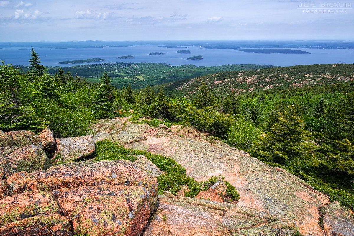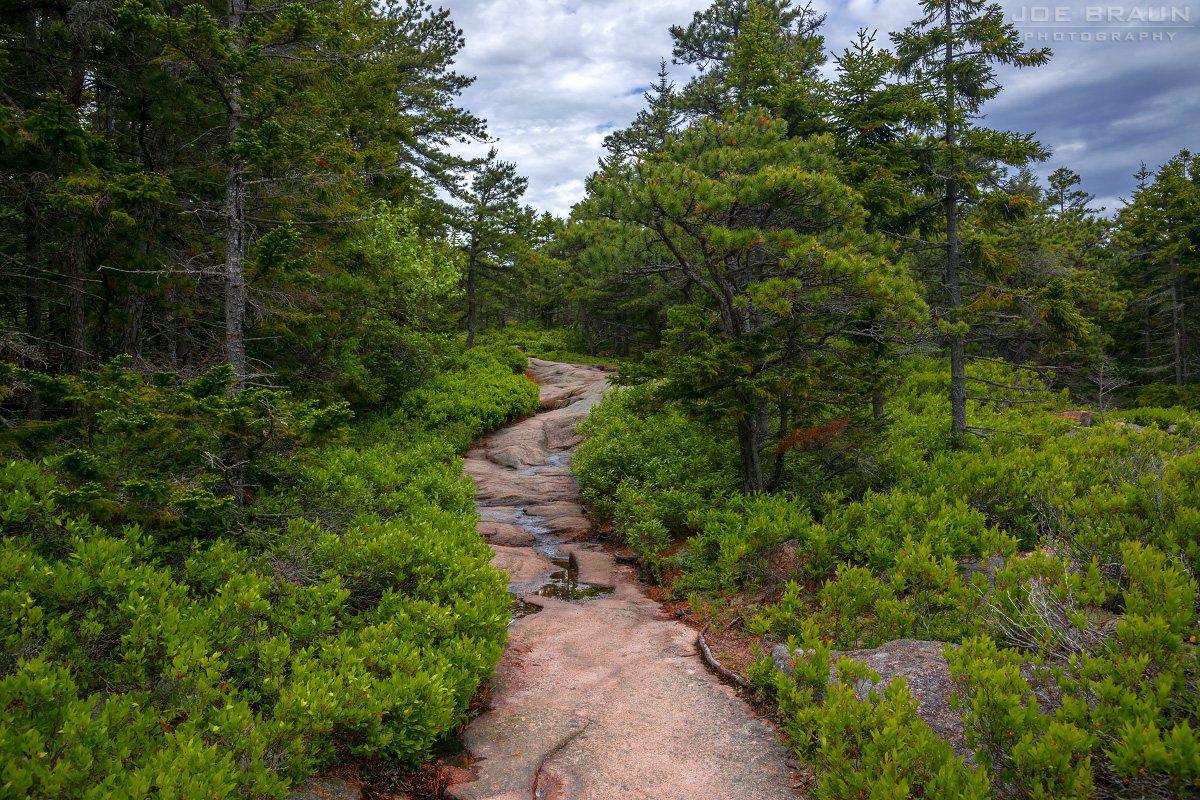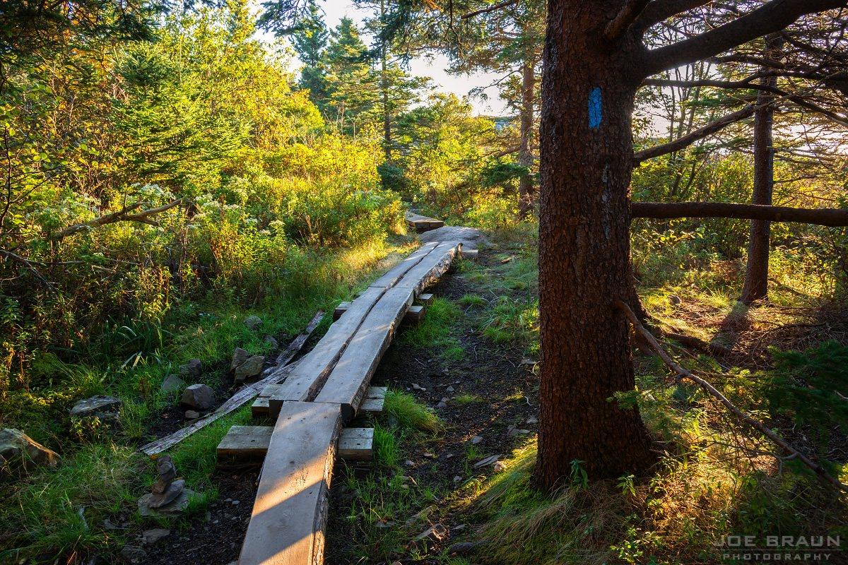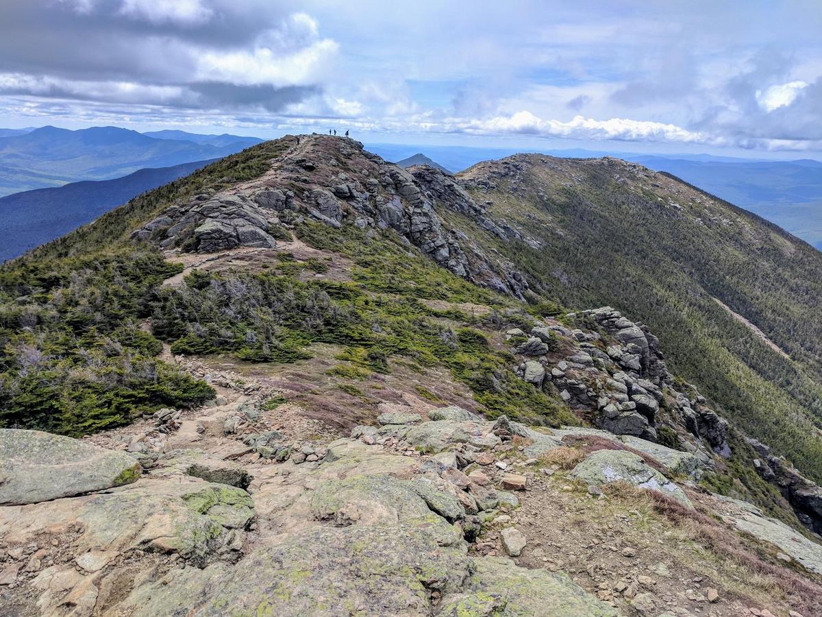
Explore Acadia
EN

Find your hike.

59 routes across the east side, quiet side, Schoodic Peninsula, and Isle au Haut. Search by name, filter the complete index, or answer five questions for one clear match.

Five-question trail match

Start with the hike that fits today.

Effort, time, exposure, scenery, and who is hiking all matter. Your answers are scored against every trail in the 59-route directory.

Question 1 of 5

How much effort feels right?

Your best match from all 59 hikes

Worth your time

5 trails we’d hike first.

Five distinct Acadia landscapes. The photos stay clean; popularity islands and full planning details remain on the Hiking page and inside each trail guide.

59 of 59 hikes
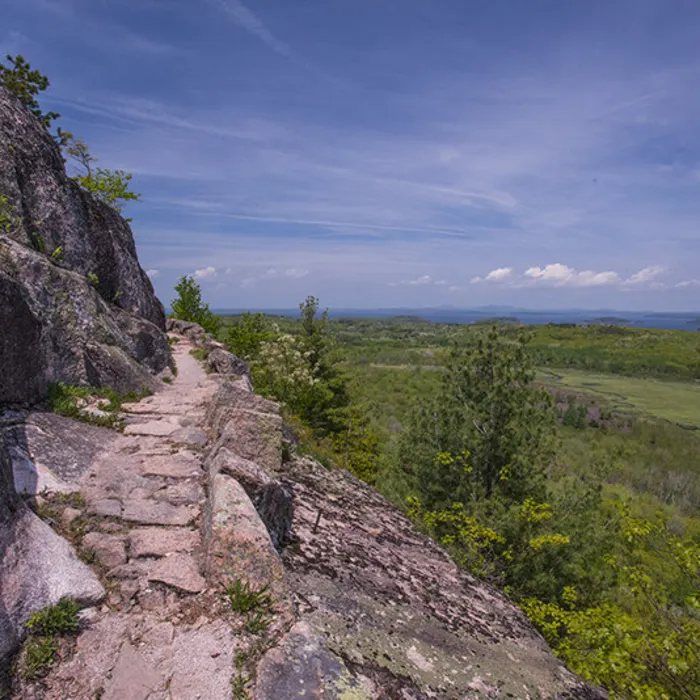
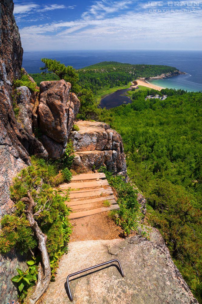
Scenery along Beehive Loop in Acadia National Park
Hard · East Side

Beehive Loop

Iron rungs, exposed ledges, and immediate ocean views.

Distance1.6 miElevation gain508 ftTime1–2 hr
5/5 popularity
View trailhead on Google Maps ↗
Trail intel · facilities, pets & conditions
Trailhead GPSSand Beach · 44.33852, -68.18338
Route typeLoop
Sun / shadeMostly open / sun-exposed
Best timeEarly morning
RestroomsSand Beach parking area
ParkingSand Beach upper lot; peak congestion is midday
DogsNot permitted on this ladder / iron-rung route
Island ExplorerSand Beach stop
AccessibilityNo trail-specific accessible route confirmed
Nearby swimSand Beach (guarded only in season)
May–Jun insectsNo trail-specific black-fly note confirmed
TicksCheck yourself and clothing after the hike
Cell serviceNot verified for this route; download offline navigation before leaving service
WaterNo potable water on trail; carry your own
BringGrippy footwear; dry conditions; secure loose gear
ChildrenNo fixed minimum age is published; use adult judgment for terrain and exposure
Fall colorEditorial foliage 2/5
WinterNot a routine winter recommendation; ice makes ironwork and steep rock hazardous
WildlifePeregrine falcons may be seen near Champlain cliffs
Photo pointUpper ledges over Sand Beach
Trail historyNo verified history line is included for this route
Plan BBeachcroft Path
After-hike foodJordan Pond House
View trailhead on Google Maps ↗Winter guide ↗
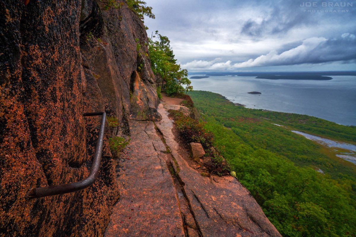
Scenery along Precipice Trail in Acadia National Park
Hard · East Side

Precipice Trail

Acadia’s boldest ladder climb on Champlain Mountain.

Distance2.7 miElevation gain1,000 ftTime2–3 hr
5/5 popularity
View trailhead on Google Maps ↗
Trail intel · facilities, pets & conditions
Trailhead GPSNot verified for this route; use the official NPS trail map
Route typePoint-to-point trail segment
Sun / shadeMostly open / sun-exposed
Best timeEarly morning
RestroomsNo trail-specific facility confirmed; check the current NPS map
ParkingPrecipice trailhead pullout; peak congestion is midday
DogsNot permitted on this ladder / iron-rung route
Island ExplorerNo trail-specific stop confirmed; check the current seasonal route map
AccessibilityNo trail-specific accessible route confirmed
Nearby swimNo designated swimming access confirmed for this route
May–Jun insectsNo trail-specific black-fly note confirmed
TicksCheck yourself and clothing after the hike
Cell serviceNot verified for this route; download offline navigation before leaving service
WaterNo potable water on trail; carry your own
BringGrippy footwear; dry conditions; secure loose gear
ChildrenNo fixed minimum age is published; use adult judgment for terrain and exposure
Fall colorEditorial foliage 3/5
WinterNot a routine winter recommendation; ice makes ironwork and steep rock hazardous
WildlifePeregrine falcons nest on Champlain cliffs; seasonal closures protect them
Photo pointChamplain Mountain ledges
Trail historyNo verified history line is included for this route
Plan BBeachcroft Path
After-hike foodNo specific nearby stop confirmed
View trailhead on Google Maps ↗Winter guide ↗
Scenery along Ocean Path in Acadia National Park
Easy · East Side

Ocean Path

A coastal walk linking Sand Beach, Thunder Hole, and Otter Point.

Good with kidsLeashed-dog pick
Distance4.1 miElevation gain351 ftTime1.5–2 hr
5/5 popularity
View trailhead on Google Maps ↗
Trail intel · facilities, pets & conditions
Trailhead GPSSand Beach · 44.33852, -68.18338
Route typePoint-to-point trail segment
Sun / shadeMostly open / sun-exposed
Best timeDaylight; Thunder Hole is strongest 1–2 hr before high tide
RestroomsSand Beach and Thunder Hole parking areas
ParkingSand Beach upper lot; Old Soaker has accessible spaces; peak congestion is midday
DogsAllowed on a leash no longer than 6 ft; verify current restrictions
Island ExplorerSand Beach or Thunder Hole stop
AccessibilityMobility-device suitable sections; surfaces vary
Nearby swimSand Beach (guarded only in season)
May–Jun insectsNo trail-specific black-fly note confirmed
TicksCheck yourself and clothing after the hike
Cell serviceNot verified for this route; download offline navigation before leaving service
WaterNo potable water on trail; carry your own
BringWind/rain layer and shoes with wet-rock grip
ChildrenCurated family pick; match distance and terrain to the youngest hiker
Fall colorEditorial foliage 2/5
WinterUnmaintained in winter; verify road access and carry traction
WildlifeSeabirds and marine wildlife may be visible offshore
Photo pointBoulder Beach and Thunder Hole
Trail historyNo verified history line is included for this route
Plan BEagle Lake Circuit
After-hike foodJordan Pond House
View trailhead on Google Maps ↗Winter guide ↗
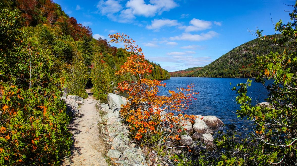
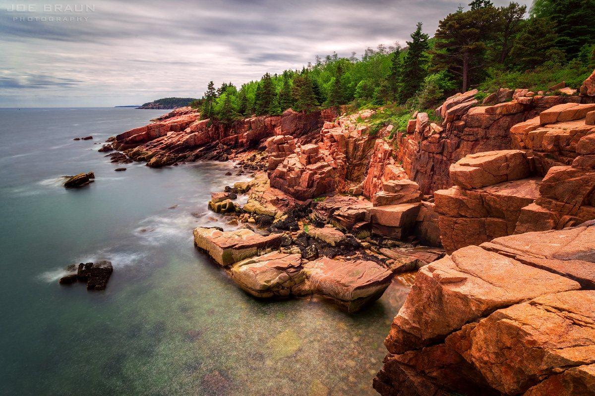
Scenery along Jordan Pond Path in Acadia National Park
Easy · East Side

Jordan Pond Path

A mostly gentle circuit around clear water beneath the Bubbles.

Good with kidsLeashed-dog pick
Distance3.3 miElevation gain52 ftTime1–1.5 hr
5/5 popularity
View trailhead on Google Maps ↗
Trail intel · facilities, pets & conditions
Trailhead GPSNot verified for this route; use the official NPS trail map
Route typeLoop
Sun / shadeMixed shade and open terrain
Best timeMorning or late afternoon
RestroomsSeasonal visitor restrooms at Jordan Pond House
ParkingJordan Pond north lot; peak congestion is midday
DogsAllowed on a leash no longer than 6 ft; verify current restrictions
Island ExplorerNo trail-specific stop confirmed; check the current seasonal route map
AccessibilityShort routes around Jordan Pond House are mobility-device suitable
Nearby swimSwimming is prohibited in Jordan Pond (public water supply)
May–Jun insectsNo trail-specific black-fly note confirmed
TicksCheck yourself and clothing after the hike
Cell serviceNot verified for this route; download offline navigation before leaving service
WaterNo potable water on trail; carry your own
BringWater, weather layer, and secure footwear
ChildrenCurated family pick; match distance and terrain to the youngest hiker
Fall colorEditorial foliage 4/5
WinterUnmaintained in winter; verify road access and carry traction
WildlifeNo trail-specific viewing note confirmed; keep a safe distance from all wildlife
Photo pointNorth-shore view toward the Bubbles
Trail historyNo verified history line is included for this route
Plan BJesup Path
After-hike foodJordan Pond House
View trailhead on Google Maps ↗Winter guide ↗
Scenery along Cadillac South Ridge in Acadia National Park
Hard · East Side

Cadillac South Ridge

A long, open ridge approach to Acadia’s highest summit.

Distance7 miElevation gain1,568 ftTime4–5 hr
5/5 popularity
View trailhead on Google Maps ↗
Trail intel · facilities, pets & conditions
Trailhead GPSNot verified for this route; use the official NPS trail map
Route typeOut-and-back
Sun / shadeMostly open / sun-exposed
Best timeSunrise or early morning
RestroomsSeasonal restrooms at Cadillac summit
ParkingNo trail-specific parking note confirmed; check current NPS access guidance
DogsAllowed on a leash no longer than 6 ft; verify current restrictions
Island ExplorerNo trail-specific stop confirmed; check the current seasonal route map
AccessibilityNo trail-specific accessible route confirmed
Nearby swimNo designated swimming access confirmed for this route
May–Jun insectsNo trail-specific black-fly note confirmed
TicksCheck yourself and clothing after the hike
Cell serviceNot verified for this route; download offline navigation before leaving service
WaterNo potable water on trail; carry your own
BringHeadlamp, warm layer, traction when icy
ChildrenNo fixed minimum age is published; use adult judgment for terrain and exposure
Fall colorEditorial foliage 3/5
WinterUnmaintained in winter; verify road access and carry traction
WildlifeRavens and migrating raptors may be seen from open summit terrain
Photo pointOpen granite below Cadillac summit
Trail historyNo verified history line is included for this route
Plan BPemetic Mountain Loop
After-hike foodNo specific nearby stop confirmed
View trailhead on Google Maps ↗Winter guide ↗
Scenery along Cadillac North Ridge in Acadia National Park
Moderate · East Side

Cadillac North Ridge

The shorter direct climb to Cadillac’s summit.

Distance4.2 miElevation gain1,135 ftTime2–3 hr
5/5 popularity
View trailhead on Google Maps ↗
Trail intel · facilities, pets & conditions
Trailhead GPSNot verified for this route; use the official NPS trail map
Route typeOut-and-back
Sun / shadeMostly open / sun-exposed
Best timeSunrise or early morning
RestroomsSeasonal restrooms at Cadillac summit
ParkingNo trail-specific parking note confirmed; check current NPS access guidance
DogsAllowed on a leash no longer than 6 ft; verify current restrictions
Island ExplorerNo trail-specific stop confirmed; check the current seasonal route map
AccessibilityNo trail-specific accessible route confirmed
Nearby swimNo designated swimming access confirmed for this route
May–Jun insectsNo trail-specific black-fly note confirmed
TicksCheck yourself and clothing after the hike
Cell serviceNot verified for this route; download offline navigation before leaving service
WaterNo potable water on trail; carry your own
BringHeadlamp, warm layer, traction when icy
ChildrenNo fixed minimum age is published; use adult judgment for terrain and exposure
Fall colorEditorial foliage 3/5
WinterUnmaintained in winter; verify road access and carry traction
WildlifeRavens and migrating raptors may be seen from open summit terrain
Photo pointCadillac summit panorama
Trail historyNo verified history line is included for this route
Plan BGorham Mountain Loop
After-hike foodNo specific nearby stop confirmed
View trailhead on Google Maps ↗Winter guide ↗
Scenery along Gorham Mountain Loop in Acadia National Park
Moderate · East Side

Gorham Mountain Loop

Granite ridges and coastal outlooks without iron ladders.

Distance3.1 miElevation gain574 ftTime2–3 hr
4/5 popularity
View trailhead on Google Maps ↗
Trail intel · facilities, pets & conditions
Trailhead GPSNot verified for this route; use the official NPS trail map
Route typeLoop
Sun / shadeMostly open / sun-exposed
Best timeEarly morning
RestroomsNearest at Sand Beach or Thunder Hole
ParkingGorham Mountain trailhead lot; peak congestion is midday
DogsAllowed on a leash no longer than 6 ft; verify current restrictions
Island ExplorerThunder Hole stop is the nearest confirmed stop
AccessibilityNo trail-specific accessible route confirmed
Nearby swimNo designated swimming access confirmed for this route
May–Jun insectsNo trail-specific black-fly note confirmed
TicksCheck yourself and clothing after the hike
Cell serviceNot verified for this route; download offline navigation before leaving service
WaterNo potable water on trail; carry your own
BringWind/rain layer and shoes with wet-rock grip
ChildrenNo fixed minimum age is published; use adult judgment for terrain and exposure
Fall colorEditorial foliage 2/5
WinterUnmaintained in winter; verify road access and carry traction
WildlifeSeabirds may be visible from coastal overlooks
Photo pointOcean-facing granite ledges
Trail historyNo verified history line is included for this route
Plan BChamplain South Ridge
After-hike foodJordan Pond House
View trailhead on Google Maps ↗Winter guide ↗
Scenery along Great Head Trail in Acadia National Park
Moderate · East Side

Great Head Trail

A compact headland loop above Sand Beach.

Distance1.6 miElevation gain298 ftTime1–2 hr
4/5 popularity
View trailhead on Google Maps ↗
Trail intel · facilities, pets & conditions
Trailhead GPSSand Beach · 44.33852, -68.18338
Route typeLoop
Sun / shadeMostly open / sun-exposed
Best timeEarly morning
RestroomsSand Beach parking area
ParkingSand Beach upper lot; peak congestion is midday
DogsAllowed on a leash no longer than 6 ft; verify current restrictions
Island ExplorerSand Beach stop
AccessibilityNo trail-specific accessible route confirmed
Nearby swimSand Beach (guarded only in season)
May–Jun insectsNo trail-specific black-fly note confirmed
TicksCheck yourself and clothing after the hike
Cell serviceNot verified for this route; download offline navigation before leaving service
WaterNo potable water on trail; carry your own
BringWind/rain layer and shoes with wet-rock grip
ChildrenNo fixed minimum age is published; use adult judgment for terrain and exposure
Fall colorEditorial foliage 2/5
WinterUnmaintained in winter; verify road access and carry traction
WildlifeSeabirds may be visible along the headland
Photo pointHeadland view over Sand Beach
Trail historyNo verified history line is included for this route
Plan BBowl Trail
After-hike foodJordan Pond House
View trailhead on Google Maps ↗Winter guide ↗
Scenery along Champlain North Ridge in Acadia National Park
Moderate · East Side

Champlain North Ridge

A steady exposed granite route to a broad summit.

Distance2.0 miElevation gain863 ftTime1.5–2 hr
3/5 popularity
View trailhead on Google Maps ↗
Trail intel · facilities, pets & conditions
Trailhead GPSNot verified for this route; use the official NPS trail map
Route typePoint-to-point trail segment
Sun / shadeMostly open / sun-exposed
Best timeDaylight; before 8am or after 5pm reduces peak congestion
RestroomsNo trail-specific facility confirmed; check the current NPS map
ParkingNo trail-specific parking note confirmed; check current NPS access guidance
DogsAllowed on a leash no longer than 6 ft; verify current restrictions
Island ExplorerNo trail-specific stop confirmed; check the current seasonal route map
AccessibilityNo trail-specific accessible route confirmed
Nearby swimNo designated swimming access confirmed for this route
May–Jun insectsNo trail-specific black-fly note confirmed
TicksCheck yourself and clothing after the hike
Cell serviceNot verified for this route; download offline navigation before leaving service
WaterNo potable water on trail; carry your own
BringWater, weather layer, and secure footwear
ChildrenNo fixed minimum age is published; use adult judgment for terrain and exposure
Fall colorEditorial foliage 3/5
WinterUnmaintained in winter; verify road access and carry traction
WildlifeNo trail-specific viewing note confirmed; keep a safe distance from all wildlife
Photo pointNo trail-specific photo point confirmed
Trail historyNo verified history line is included for this route
Plan BTriad Trail
After-hike foodNo specific nearby stop confirmed
View trailhead on Google Maps ↗Winter guide ↗
Scenery along Champlain South Ridge in Acadia National Park
Moderate · East Side

Champlain South Ridge

A quieter ridge option near The Bowl.

Time2–3 hr
3/5 popularity
View trailhead on Google Maps ↗
Trail intel · facilities, pets & conditions
Trailhead GPSNot verified for this route; use the official NPS trail map
Route typePoint-to-point trail segment
Sun / shadeMostly open / sun-exposed
Best timeDaylight; before 8am or after 5pm reduces peak congestion
RestroomsNo trail-specific facility confirmed; check the current NPS map
ParkingNo trail-specific parking note confirmed; check current NPS access guidance
DogsAllowed on a leash no longer than 6 ft; verify current restrictions
Island ExplorerNo trail-specific stop confirmed; check the current seasonal route map
AccessibilityNo trail-specific accessible route confirmed
Nearby swimNo designated swimming access confirmed for this route
May–Jun insectsBlack flies / mosquitoes can be active
TicksCheck yourself and clothing after the hike
Cell serviceNot verified for this route; download offline navigation before leaving service
WaterNo potable water on trail; carry your own
BringWater, weather layer, and secure footwear
ChildrenNo fixed minimum age is published; use adult judgment for terrain and exposure
Fall colorEditorial foliage 4/5
WinterUnmaintained in winter; verify road access and carry traction
WildlifeNo trail-specific viewing note confirmed; keep a safe distance from all wildlife
Photo pointNo trail-specific photo point confirmed
Trail historyNo verified history line is included for this route
Plan BCanon Brook Trail
After-hike foodNo specific nearby stop confirmed
View trailhead on Google Maps ↗Winter guide ↗
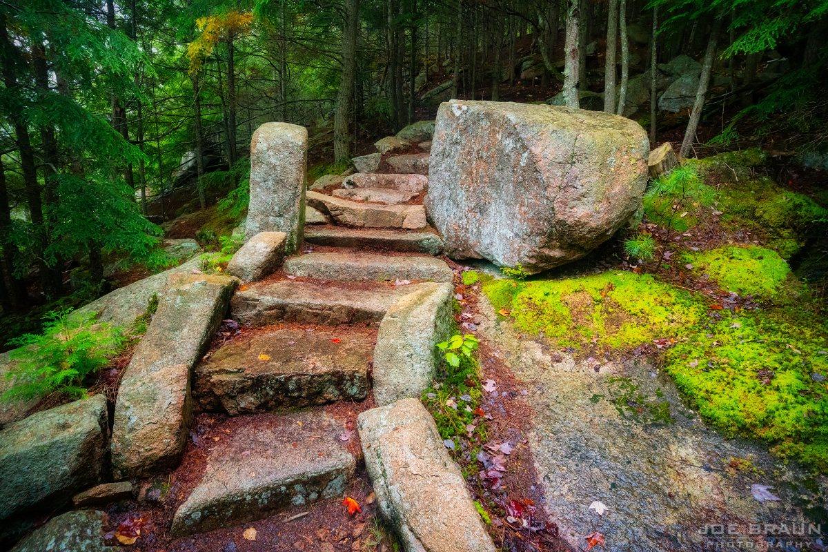
Scenery along Beachcroft Path in Acadia National Park
Hard · East Side

Beachcroft Path

Historic stone steps rise from The Tarn toward Champlain.

Distance2.4 miElevation gain948 ftTime2–3 hr
4/5 popularity
View trailhead on Google Maps ↗
Trail intel · facilities, pets & conditions
Trailhead GPSNot verified for this route; use the official NPS trail map
Route typePoint-to-point trail segment
Sun / shadeMostly open / sun-exposed
Best timeDaylight; before 8am or after 5pm reduces peak congestion
RestroomsNo trail-specific facility confirmed; check the current NPS map
ParkingNo trail-specific parking note confirmed; check current NPS access guidance
DogsLeashed dogs allowed, but NPS says this route is not appropriate for pets
Island ExplorerNo trail-specific stop confirmed; check the current seasonal route map
AccessibilityNo trail-specific accessible route confirmed
Nearby swimNo designated swimming access confirmed for this route
May–Jun insectsNo trail-specific black-fly note confirmed
TicksCheck yourself and clothing after the hike
Cell serviceNot verified for this route; download offline navigation before leaving service
WaterNo potable water on trail; carry your own
BringSturdy footwear, layers, and offline navigation
ChildrenNo fixed minimum age is published; use adult judgment for terrain and exposure
Fall colorEditorial foliage 3/5
WinterUnmaintained in winter; verify road access and carry traction
WildlifeNo trail-specific viewing note confirmed; keep a safe distance from all wildlife
Photo pointNo trail-specific photo point confirmed
Trail historyNo verified history line is included for this route
Plan BGorge Path
After-hike foodNo specific nearby stop confirmed
View trailhead on Google Maps ↗Winter guide ↗
Scenery along Bowl Trail in Acadia National Park
Moderate · East Side

Bowl Trail

A wooded connection from Sand Beach to a mountain pond.

Distance1.3 miElevation gain400 ftTime1–1.5 hr
3/5 popularity
View trailhead on Google Maps ↗
Trail intel · facilities, pets & conditions
Trailhead GPSSand Beach · 44.33852, -68.18338
Route typePoint-to-point trail segment
Sun / shadeMostly wooded / shaded
Best timeEarly morning
RestroomsSand Beach parking area
ParkingSand Beach upper lot; peak congestion is midday
DogsAllowed on a leash no longer than 6 ft; verify current restrictions
Island ExplorerSand Beach stop
AccessibilityNo trail-specific accessible route confirmed
Nearby swimSand Beach (guarded only in season)
May–Jun insectsBlack flies / mosquitoes can be active
TicksCheck yourself and clothing after the hike
Cell serviceNot verified for this route; download offline navigation before leaving service
WaterNo potable water on trail; carry your own
BringWater, weather layer, and secure footwear
ChildrenNo fixed minimum age is published; use adult judgment for terrain and exposure
Fall colorEditorial foliage 5/5
WinterUnmaintained in winter; verify road access and carry traction
WildlifeNo trail-specific viewing note confirmed; keep a safe distance from all wildlife
Photo pointNo trail-specific photo point confirmed
Trail historyNo verified history line is included for this route
Plan BTriad Trail
After-hike foodJordan Pond House
View trailhead on Google Maps ↗Winter guide ↗
Scenery along Dorr Mountain Ladder Trail in Acadia National Park
Hard · East Side

Dorr Mountain Ladder Trail

Steep stonework and ladders climb Dorr’s eastern face.

Distance2.1 miElevation gain1,135 ftTime1.5–2 hr
4/5 popularity
View trailhead on Google Maps ↗
Trail intel · facilities, pets & conditions
Trailhead GPSNot verified for this route; use the official NPS trail map
Route typePoint-to-point trail segment
Sun / shadeMostly open / sun-exposed
Best timeDry daylight hours
RestroomsAccessible bathrooms at Sieur de Monts
ParkingSieur de Monts parking area; peak congestion is midday
DogsNot permitted on this ladder / iron-rung route
Island Explorer#4 Loop Road or #10 Blackwoods at Sieur de Monts
AccessibilityNo trail-specific accessible route confirmed
Nearby swimNo designated swimming access confirmed for this route
May–Jun insectsNo trail-specific black-fly note confirmed
TicksCheck yourself and clothing after the hike
Cell serviceNot verified for this route; download offline navigation before leaving service
WaterNo potable water on trail; carry your own
BringGrippy footwear; dry conditions; secure loose gear
ChildrenNo fixed minimum age is published; use adult judgment for terrain and exposure
Fall colorEditorial foliage 3/5
WinterNot a routine winter recommendation; ice makes ironwork and steep rock hazardous
WildlifeNo trail-specific viewing note confirmed; keep a safe distance from all wildlife
Photo pointNo trail-specific photo point confirmed
Trail historyNo verified history line is included for this route
Plan BPenobscot Mountain Trail
After-hike foodNo specific nearby stop confirmed
View trailhead on Google Maps ↗Winter guide ↗
Scenery along Dorr Mountain South Ridge in Acadia National Park
Moderate · East Side

Dorr Mountain South Ridge

Open granite and views toward Cadillac.

Time2–3 hr
2/5 popularity
View trailhead on Google Maps ↗
Trail intel · facilities, pets & conditions
Trailhead GPSNot verified for this route; use the official NPS trail map
Route typePoint-to-point trail segment
Sun / shadeMostly open / sun-exposed
Best timeDaylight; before 8am or after 5pm reduces peak congestion
RestroomsNo trail-specific facility confirmed; check the current NPS map
ParkingNo trail-specific parking note confirmed; check current NPS access guidance
DogsAllowed on a leash no longer than 6 ft; verify current restrictions
Island ExplorerNo trail-specific stop confirmed; check the current seasonal route map
AccessibilityNo trail-specific accessible route confirmed
Nearby swimNo designated swimming access confirmed for this route
May–Jun insectsNo trail-specific black-fly note confirmed
TicksCheck yourself and clothing after the hike
Cell serviceNot verified for this route; download offline navigation before leaving service
WaterNo potable water on trail; carry your own
BringWater, weather layer, and secure footwear
ChildrenNo fixed minimum age is published; use adult judgment for terrain and exposure
Fall colorEditorial foliage 3/5
WinterUnmaintained in winter; verify road access and carry traction
WildlifeNo trail-specific viewing note confirmed; keep a safe distance from all wildlife
Photo pointNo trail-specific photo point confirmed
Trail historyNo verified history line is included for this route
Plan BStrath Eden Path
After-hike foodNo specific nearby stop confirmed
View trailhead on Google Maps ↗Winter guide ↗
Scenery along Kurt Diederich’s Climb in Acadia National Park
Hard · East Side

Kurt Diederich’s Climb

A dramatic historic path of stone steps and ledges.

Distance1 miElevation gain446 ftTime0.5–1 hr
2/5 popularity
View trailhead on Google Maps ↗
Trail intel · facilities, pets & conditions
Trailhead GPSNot verified for this route; use the official NPS trail map
Route typePoint-to-point trail segment
Sun / shadeMixed shade and open terrain
Best timeDry daylight hours
RestroomsAccessible bathrooms at Sieur de Monts
ParkingSieur de Monts parking area; peak congestion is midday
DogsAllowed on a leash no longer than 6 ft; verify current restrictions
Island Explorer#4 Loop Road or #10 Blackwoods at Sieur de Monts
AccessibilityNo trail-specific accessible route confirmed
Nearby swimNo designated swimming access confirmed for this route
May–Jun insectsNo trail-specific black-fly note confirmed
TicksCheck yourself and clothing after the hike
Cell serviceNot verified for this route; download offline navigation before leaving service
WaterNo potable water on trail; carry your own
BringSturdy footwear, layers, and offline navigation
ChildrenNo fixed minimum age is published; use adult judgment for terrain and exposure
Fall colorEditorial foliage 3/5
WinterUnmaintained in winter; verify road access and carry traction
WildlifeNo trail-specific viewing note confirmed; keep a safe distance from all wildlife
Photo pointNo trail-specific photo point confirmed
Trail historyNo verified history line is included for this route
Plan BA. Murray Young Path
After-hike foodNo specific nearby stop confirmed
View trailhead on Google Maps ↗Winter guide ↗
Scenery along Emery Path in Acadia National Park
Hard · East Side

Emery Path

Tight switchbacks and stone staircases above Sieur de Monts.

Time1–1.5 hr
2/5 popularity
View trailhead on Google Maps ↗
Trail intel · facilities, pets & conditions
Trailhead GPSNot verified for this route; use the official NPS trail map
Route typePoint-to-point trail segment
Sun / shadeMixed shade and open terrain
Best timeMorning
RestroomsAccessible bathrooms at Sieur de Monts
ParkingSieur de Monts parking area; peak congestion is midday
DogsAllowed on a leash no longer than 6 ft; verify current restrictions
Island Explorer#4 Loop Road or #10 Blackwoods at Sieur de Monts
AccessibilityNo trail-specific accessible route confirmed
Nearby swimNo designated swimming access confirmed for this route
May–Jun insectsNo trail-specific black-fly note confirmed
TicksCheck yourself and clothing after the hike
Cell serviceNot verified for this route; download offline navigation before leaving service
WaterNo potable water on trail; carry your own
BringSturdy footwear, layers, and offline navigation
ChildrenNo fixed minimum age is published; use adult judgment for terrain and exposure
Fall colorEditorial foliage 3/5
WinterUnmaintained in winter; verify road access and carry traction
WildlifeNo trail-specific viewing note confirmed; keep a safe distance from all wildlife
Photo pointNo trail-specific photo point confirmed
Trail historyNo verified history line is included for this route
Plan BA. Murray Young Path
After-hike foodNo specific nearby stop confirmed
View trailhead on Google Maps ↗Winter guide ↗
Scenery along Homans Path in Acadia National Park
Hard · East Side

Homans Path

Stone stairs, narrow passages, and crafted trailwork.

Distance0.8 miElevation gain334 ftTime1–1.5 hr
3/5 popularity
View trailhead on Google Maps ↗
Trail intel · facilities, pets & conditions
Trailhead GPSNot verified for this route; use the official NPS trail map
Route typePoint-to-point trail segment
Sun / shadeMixed shade and open terrain
Best timeMorning
RestroomsAccessible bathrooms at Sieur de Monts
ParkingSieur de Monts parking area; peak congestion is midday
DogsAllowed on a leash no longer than 6 ft; verify current restrictions
Island Explorer#4 Loop Road or #10 Blackwoods at Sieur de Monts
AccessibilityNo trail-specific accessible route confirmed
Nearby swimNo designated swimming access confirmed for this route
May–Jun insectsNo trail-specific black-fly note confirmed
TicksCheck yourself and clothing after the hike
Cell serviceNot verified for this route; download offline navigation before leaving service
WaterNo potable water on trail; carry your own
BringSturdy footwear, layers, and offline navigation
ChildrenNo fixed minimum age is published; use adult judgment for terrain and exposure
Fall colorEditorial foliage 3/5
WinterUnmaintained in winter; verify road access and carry traction
WildlifeNo trail-specific viewing note confirmed; keep a safe distance from all wildlife
Photo pointNo trail-specific photo point confirmed
Trail historyRockfall from the 2006 Mount Desert Island earthquakes damaged the path; NPS trail crews later rehabilitated its stone staircases.
Plan BEmery Path
After-hike foodNo specific nearby stop confirmed
View trailhead on Google Maps ↗Winter guide ↗
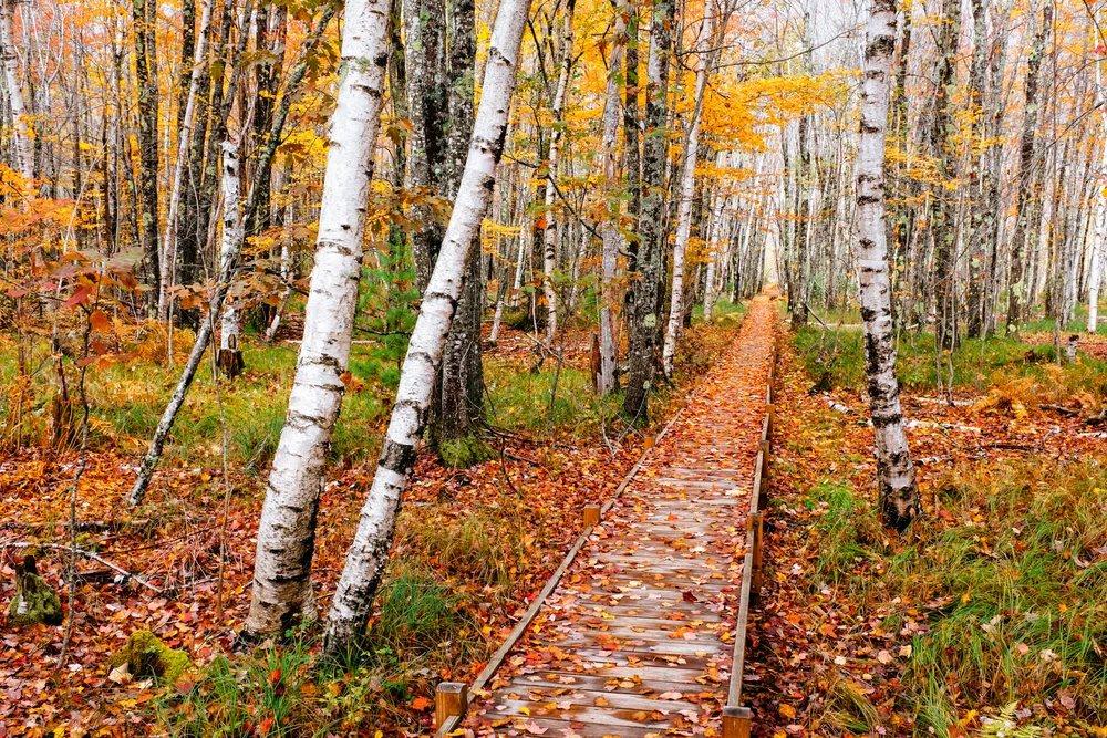
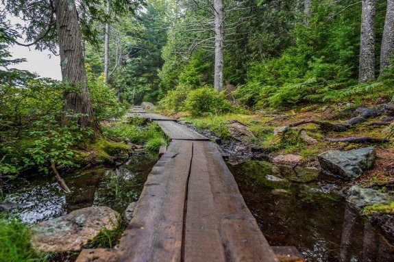
Scenery along Jesup Path in Acadia National Park
Easy · East Side

Jesup Path

Boardwalk through birch forest and wet meadow.

Good with kidsLeashed-dog pick
Distance2.1 miElevation gain82 ftTime0.5–1 hr
4/5 popularity
View trailhead on Google Maps ↗
Trail intel · facilities, pets & conditions
Trailhead GPSNot verified for this route; use the official NPS trail map
Route typePoint-to-point trail segment
Sun / shadeMostly wooded / shaded
Best timeMorning
RestroomsAccessible bathrooms across from the trailhead
ParkingSieur de Monts parking area; peak congestion is midday
DogsAllowed on a leash no longer than 6 ft; verify current restrictions
Island Explorer#4 Loop Road or #10 Blackwoods at Sieur de Monts
Accessibility3-ft boardwalk; may not suit every wheelchair or mobility scooter
Nearby swimNo designated swimming access confirmed for this route
May–Jun insectsBlack flies / mosquitoes can be active
TicksCheck yourself and clothing after the hike
Cell serviceNot verified for this route; download offline navigation before leaving service
WaterNo potable water on trail; carry your own
BringWater, weather layer, and secure footwear
ChildrenCurated family pick; match distance and terrain to the youngest hiker
Fall colorEditorial foliage 5/5
WinterUnmaintained in winter; verify road access and carry traction
WildlifeNo trail-specific viewing note confirmed; keep a safe distance from all wildlife
Photo pointNo trail-specific photo point confirmed
Trail historyNo verified history line is included for this route
Plan BHemlock Road
After-hike foodNo specific nearby stop confirmed
View trailhead on Google Maps ↗Winter guide ↗
Scenery along Hemlock Road in Acadia National Park
Easy · East Side

Hemlock Road

A relaxed woodland connector near Sieur de Monts.

Distance1.7 miElevation gain269 ftTime1 hr
2/5 popularity
View trailhead on Google Maps ↗
Trail intel · facilities, pets & conditions
Trailhead GPSNot verified for this route; use the official NPS trail map
Route typePoint-to-point trail segment
Sun / shadeMostly wooded / shaded
Best timeMorning
RestroomsAccessible bathrooms across from the trailhead
ParkingSieur de Monts parking area; peak congestion is midday
DogsAllowed on a leash no longer than 6 ft; verify current restrictions
Island Explorer#4 Loop Road or #10 Blackwoods at Sieur de Monts
AccessibilityListed by NPS as suitable for mobility devices
Nearby swimNo designated swimming access confirmed for this route
May–Jun insectsBlack flies / mosquitoes can be active
TicksCheck yourself and clothing after the hike
Cell serviceNot verified for this route; download offline navigation before leaving service
WaterNo potable water on trail; carry your own
BringWater, weather layer, and secure footwear
ChildrenNo fixed minimum age is published; use adult judgment for terrain and exposure
Fall colorEditorial foliage 5/5
WinterUnmaintained in winter; verify road access and carry traction
WildlifeNo trail-specific viewing note confirmed; keep a safe distance from all wildlife
Photo pointNo trail-specific photo point confirmed
Trail historyNo verified history line is included for this route
Plan BKane Path
After-hike foodNo specific nearby stop confirmed
View trailhead on Google Maps ↗Winter guide ↗
Scenery along Kane Path in Acadia National Park
Easy · East Side

Kane Path

A pond-edge path beneath Dorr Mountain.

Time1 hr
2/5 popularity
View trailhead on Google Maps ↗
Trail intel · facilities, pets & conditions
Trailhead GPSNot verified for this route; use the official NPS trail map
Route typePoint-to-point trail segment
Sun / shadeMixed shade and open terrain
Best timeDaylight; before 8am or after 5pm reduces peak congestion
RestroomsNo trail-specific facility confirmed; check the current NPS map
ParkingNo trail-specific parking note confirmed; check current NPS access guidance
DogsAllowed on a leash no longer than 6 ft; verify current restrictions
Island ExplorerNo trail-specific stop confirmed; check the current seasonal route map
AccessibilityNo trail-specific accessible route confirmed
Nearby swimNo designated swimming access confirmed for this route
May–Jun insectsBlack flies / mosquitoes can be active
TicksCheck yourself and clothing after the hike
Cell serviceNot verified for this route; download offline navigation before leaving service
WaterNo potable water on trail; carry your own
BringWater, weather layer, and secure footwear
ChildrenNo fixed minimum age is published; use adult judgment for terrain and exposure
Fall colorEditorial foliage 4/5
WinterUnmaintained in winter; verify road access and carry traction
WildlifeNo trail-specific viewing note confirmed; keep a safe distance from all wildlife
Photo pointNo trail-specific photo point confirmed
Trail historyNo verified history line is included for this route
Plan BHemlock Road
After-hike foodNo specific nearby stop confirmed
View trailhead on Google Maps ↗Winter guide ↗
Scenery along Strath Eden Path in Acadia National Park
Moderate · East Side

Strath Eden Path

A forested route between valleys and mountain paths.

Time1.5–2 hr
1/5 popularity
View trailhead on Google Maps ↗
Trail intel · facilities, pets & conditions
Trailhead GPSNot verified for this route; use the official NPS trail map
Route typePoint-to-point trail segment
Sun / shadeMostly wooded / shaded
Best timeDaylight; before 8am or after 5pm reduces peak congestion
RestroomsNo trail-specific facility confirmed; check the current NPS map
ParkingNo trail-specific parking note confirmed; check current NPS access guidance
DogsAllowed on a leash no longer than 6 ft; verify current restrictions
Island ExplorerNo trail-specific stop confirmed; check the current seasonal route map
AccessibilityNo trail-specific accessible route confirmed
Nearby swimNo designated swimming access confirmed for this route
May–Jun insectsBlack flies / mosquitoes can be active
TicksCheck yourself and clothing after the hike
Cell serviceNot verified for this route; download offline navigation before leaving service
WaterNo potable water on trail; carry your own
BringWater, weather layer, and secure footwear
ChildrenNo fixed minimum age is published; use adult judgment for terrain and exposure
Fall colorEditorial foliage 5/5
WinterUnmaintained in winter; verify road access and carry traction
WildlifeNo trail-specific viewing note confirmed; keep a safe distance from all wildlife
Photo pointNo trail-specific photo point confirmed
Trail historyNo verified history line is included for this route
Plan BTriad Trail
After-hike foodNo specific nearby stop confirmed
View trailhead on Google Maps ↗Winter guide ↗
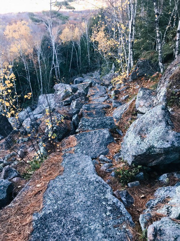
Scenery along Gorge Path in Acadia National Park
Hard · East Side

Gorge Path

Boulder-strewn terrain in the cleft between Dorr and Cadillac.

Distance3.4 miElevation gain1,256 ftTime2–3 hr
3/5 popularity
View trailhead on Google Maps ↗
Trail intel · facilities, pets & conditions
Trailhead GPSNot verified for this route; use the official NPS trail map
Route typePoint-to-point trail segment
Sun / shadeMixed shade and open terrain
Best timeDaylight; before 8am or after 5pm reduces peak congestion
RestroomsNo trail-specific facility confirmed; check the current NPS map
ParkingNo trail-specific parking note confirmed; check current NPS access guidance
DogsLeashed dogs allowed, but NPS says this route is not appropriate for pets
Island ExplorerNo trail-specific stop confirmed; check the current seasonal route map
AccessibilityNo trail-specific accessible route confirmed
Nearby swimNo designated swimming access confirmed for this route
May–Jun insectsNo trail-specific black-fly note confirmed
TicksCheck yourself and clothing after the hike
Cell serviceNot verified for this route; download offline navigation before leaving service
WaterNo potable water on trail; carry your own
BringSturdy footwear, layers, and offline navigation
ChildrenNo fixed minimum age is published; use adult judgment for terrain and exposure
Fall colorEditorial foliage 3/5
WinterUnmaintained in winter; verify road access and carry traction
WildlifeNo trail-specific viewing note confirmed; keep a safe distance from all wildlife
Photo pointNo trail-specific photo point confirmed
Trail historyNo verified history line is included for this route
Plan BEmery Path
After-hike foodNo specific nearby stop confirmed
View trailhead on Google Maps ↗Winter guide ↗
Scenery along A. Murray Young Path in Acadia National Park
Hard · East Side

A. Murray Young Path

Rugged stone steps and cascades on the way to Dorr.

Time2–3 hr
0/5 popularity
View trailhead on Google Maps ↗
Trail intel · facilities, pets & conditions
Trailhead GPSNot verified for this route; use the official NPS trail map
Route typePoint-to-point trail segment
Sun / shadeMixed shade and open terrain
Best timeDaylight; before 8am or after 5pm reduces peak congestion
RestroomsNo trail-specific facility confirmed; check the current NPS map
ParkingNo trail-specific parking note confirmed; check current NPS access guidance
DogsAllowed on a leash no longer than 6 ft; verify current restrictions
Island ExplorerNo trail-specific stop confirmed; check the current seasonal route map
AccessibilityNo trail-specific accessible route confirmed
Nearby swimNo designated swimming access confirmed for this route
May–Jun insectsBlack flies / mosquitoes can be active
TicksCheck yourself and clothing after the hike
Cell serviceNot verified for this route; download offline navigation before leaving service
WaterNo potable water on trail; carry your own
BringSturdy footwear, layers, and offline navigation
ChildrenNo fixed minimum age is published; use adult judgment for terrain and exposure
Fall colorEditorial foliage 4/5
WinterUnmaintained in winter; verify road access and carry traction
WildlifeNo trail-specific viewing note confirmed; keep a safe distance from all wildlife
Photo pointNo trail-specific photo point confirmed
Trail historyNo verified history line is included for this route
Plan BBeachcroft Path
After-hike foodNo specific nearby stop confirmed
View trailhead on Google Maps ↗Winter guide ↗
Scenery along Canon Brook Trail in Acadia National Park
Moderate · East Side

Canon Brook Trail

Woodland and stream crossings below Cadillac.

Distance3.8 miElevation gain974 ftTime2–2.5 hr
2/5 popularity
View trailhead on Google Maps ↗
Trail intel · facilities, pets & conditions
Trailhead GPSNot verified for this route; use the official NPS trail map
Route typePoint-to-point trail segment
Sun / shadeMostly wooded / shaded
Best timeDaylight; before 8am or after 5pm reduces peak congestion
RestroomsNo trail-specific facility confirmed; check the current NPS map
ParkingNo trail-specific parking note confirmed; check current NPS access guidance
DogsAllowed on a leash no longer than 6 ft; verify current restrictions
Island ExplorerNo trail-specific stop confirmed; check the current seasonal route map
AccessibilityNo trail-specific accessible route confirmed
Nearby swimNo designated swimming access confirmed for this route
May–Jun insectsBlack flies / mosquitoes can be active
TicksCheck yourself and clothing after the hike
Cell serviceNot verified for this route; download offline navigation before leaving service
WaterNo potable water on trail; carry your own
BringWater, weather layer, and secure footwear
ChildrenNo fixed minimum age is published; use adult judgment for terrain and exposure
Fall colorEditorial foliage 5/5
WinterUnmaintained in winter; verify road access and carry traction
WildlifeNo trail-specific viewing note confirmed; keep a safe distance from all wildlife
Photo pointNo trail-specific photo point confirmed
Trail historyNo verified history line is included for this route
Plan BStrath Eden Path
After-hike foodNo specific nearby stop confirmed
View trailhead on Google Maps ↗Winter guide ↗
Scenery along Pemetic Mountain Loop in Acadia National Park
Hard · East Side

Pemetic Mountain Loop

Steep gullies and wide summit granite.

Distance4.5 miElevation gain1,062 ftTime2.5–3 hr
4/5 popularity
View trailhead on Google Maps ↗
Trail intel · facilities, pets & conditions
Trailhead GPSNot verified for this route; use the official NPS trail map
Route typeLoop
Sun / shadeMostly open / sun-exposed
Best timeDaylight; before 8am or after 5pm reduces peak congestion
RestroomsNo trail-specific facility confirmed; check the current NPS map
ParkingNo trail-specific parking note confirmed; check current NPS access guidance
DogsLeashed dogs allowed, but NPS says this route is not appropriate for pets
Island ExplorerNo trail-specific stop confirmed; check the current seasonal route map
AccessibilityNo trail-specific accessible route confirmed
Nearby swimNo designated swimming access confirmed for this route
May–Jun insectsNo trail-specific black-fly note confirmed
TicksCheck yourself and clothing after the hike
Cell serviceNot verified for this route; download offline navigation before leaving service
WaterNo potable water on trail; carry your own
BringSturdy footwear, layers, and offline navigation
ChildrenNo fixed minimum age is published; use adult judgment for terrain and exposure
Fall colorEditorial foliage 3/5
WinterUnmaintained in winter; verify road access and carry traction
WildlifeNo trail-specific viewing note confirmed; keep a safe distance from all wildlife
Photo pointNo trail-specific photo point confirmed
Trail historyNo verified history line is included for this route
Plan BPenobscot Mountain Trail
After-hike foodNo specific nearby stop confirmed
View trailhead on Google Maps ↗Winter guide ↗
Scenery along Bubble Rock Trail in Acadia National Park
Moderate · East Side

Bubble Rock Trail

A short climb to the famous perched boulder.

Good with kids
Time1 hr
5/5 popularity
View trailhead on Google Maps ↗
Trail intel · facilities, pets & conditions
Trailhead GPSNot verified for this route; use the official NPS trail map
Route typeOut-and-back
Sun / shadeMixed shade and open terrain
Best timeMorning
RestroomsNearest seasonal restrooms at Jordan Pond House
ParkingBubbles Divide trailhead lot; peak congestion is midday
DogsAllowed on a leash no longer than 6 ft; verify current restrictions
Island ExplorerNo trail-specific stop confirmed; check the current seasonal route map
AccessibilityNo trail-specific accessible route confirmed
Nearby swimSwimming is prohibited in Jordan Pond (public water supply)
May–Jun insectsNo trail-specific black-fly note confirmed
TicksCheck yourself and clothing after the hike
Cell serviceNot verified for this route; download offline navigation before leaving service
WaterNo potable water on trail; carry your own
BringWater, weather layer, and secure footwear
ChildrenCurated family pick; match distance and terrain to the youngest hiker
Fall colorEditorial foliage 3/5
WinterUnmaintained in winter; verify road access and carry traction
WildlifeNo trail-specific viewing note confirmed; keep a safe distance from all wildlife
Photo pointBubble Rock overlook
Trail historyNo verified history line is included for this route
Plan BSouth Bubble Summit
After-hike foodJordan Pond House
View trailhead on Google Maps ↗Winter guide ↗
Scenery along South Bubble Summit in Acadia National Park
Moderate · East Side

South Bubble Summit

A quick summit above Jordan Pond.

Distance1.2 miElevation gain295 ftTime0.5–1 hr
4/5 popularity
View trailhead on Google Maps ↗
Trail intel · facilities, pets & conditions
Trailhead GPSNot verified for this route; use the official NPS trail map
Route typeOut-and-back
Sun / shadeMostly open / sun-exposed
Best timeMorning
RestroomsNearest seasonal restrooms at Jordan Pond House
ParkingBubbles Divide trailhead lot; peak congestion is midday
DogsAllowed on a leash no longer than 6 ft; verify current restrictions
Island ExplorerNo trail-specific stop confirmed; check the current seasonal route map
AccessibilityNo trail-specific accessible route confirmed
Nearby swimSwimming is prohibited in Jordan Pond (public water supply)
May–Jun insectsNo trail-specific black-fly note confirmed
TicksCheck yourself and clothing after the hike
Cell serviceNot verified for this route; download offline navigation before leaving service
WaterNo potable water on trail; carry your own
BringWater, weather layer, and secure footwear
ChildrenNo fixed minimum age is published; use adult judgment for terrain and exposure
Fall colorEditorial foliage 4/5
WinterUnmaintained in winter; verify road access and carry traction
WildlifeNo trail-specific viewing note confirmed; keep a safe distance from all wildlife
Photo pointJordan Pond overlook
Trail historyNo verified history line is included for this route
Plan BBowl Trail
After-hike foodJordan Pond House
View trailhead on Google Maps ↗Winter guide ↗
Scenery along North Bubble Loop in Acadia National Park
Moderate · East Side

North Bubble Loop

Twin summits and classic Jordan Pond overlooks.

Time2–3 hr
4/5 popularity
View trailhead on Google Maps ↗
Trail intel · facilities, pets & conditions
Trailhead GPSNot verified for this route; use the official NPS trail map
Route typeLoop
Sun / shadeMostly open / sun-exposed
Best timeMorning
RestroomsNearest seasonal restrooms at Jordan Pond House
ParkingBubbles Divide trailhead lot; peak congestion is midday
DogsAllowed on a leash no longer than 6 ft; verify current restrictions
Island ExplorerNo trail-specific stop confirmed; check the current seasonal route map
AccessibilityNo trail-specific accessible route confirmed
Nearby swimSwimming is prohibited in Jordan Pond (public water supply)
May–Jun insectsNo trail-specific black-fly note confirmed
TicksCheck yourself and clothing after the hike
Cell serviceNot verified for this route; download offline navigation before leaving service
WaterNo potable water on trail; carry your own
BringWater, weather layer, and secure footwear
ChildrenNo fixed minimum age is published; use adult judgment for terrain and exposure
Fall colorEditorial foliage 4/5
WinterUnmaintained in winter; verify road access and carry traction
WildlifeNo trail-specific viewing note confirmed; keep a safe distance from all wildlife
Photo pointNorth Bubble ledges
Trail historyNo verified history line is included for this route
Plan BChamplain South Ridge
After-hike foodJordan Pond House
View trailhead on Google Maps ↗Winter guide ↗
Scenery along Eagle Lake Circuit in Acadia National Park
Easy · East Side

Eagle Lake Circuit

A broad carriage-road loop around the lake.

Leashed-dog pick
Time2.5–3.5 hr
4/5 popularity
View trailhead on Google Maps ↗
Trail intel · facilities, pets & conditions
Trailhead GPSNot verified for this route; use the official NPS trail map
Route typeLoop
Sun / shadeMixed shade and open terrain
Best timeDaylight; before 8am or after 5pm reduces peak congestion
RestroomsNo trail-specific facility confirmed; check the current NPS map
ParkingNo trail-specific parking note confirmed; check current NPS access guidance
DogsAllowed on a leash no longer than 6 ft; verify current restrictions
Island ExplorerNo trail-specific stop confirmed; check the current seasonal route map
AccessibilityNo trail-specific accessible route confirmed
Nearby swimNo designated swimming access confirmed for this route
May–Jun insectsNo trail-specific black-fly note confirmed
TicksCheck yourself and clothing after the hike
Cell serviceNot verified for this route; download offline navigation before leaving service
WaterNo potable water on trail; carry your own
BringWater, weather layer, and secure footwear
ChildrenNo fixed minimum age is published; use adult judgment for terrain and exposure
Fall colorEditorial foliage 4/5
WinterCarriage roads can suit snowshoes or XC skis when snowpack and closures allow
WildlifeNo trail-specific viewing note confirmed; keep a safe distance from all wildlife
Photo pointNo trail-specific photo point confirmed
Trail historyThe carriage-road network was built from 1913–1940 as a gift of John D. Rockefeller Jr. and family.
Plan BHemlock Road
After-hike foodNo specific nearby stop confirmed
View trailhead on Google Maps ↗Winter guide ↗
Scenery along Conners Nubble in Acadia National Park
Moderate · East Side

Conners Nubble

A quieter rocky viewpoint above Eagle Lake.

Distance3.5 miElevation gain374 ftTime2–3 hr
2/5 popularity
View trailhead on Google Maps ↗
Trail intel · facilities, pets & conditions
Trailhead GPSNot verified for this route; use the official NPS trail map
Route typePoint-to-point trail segment
Sun / shadeMixed shade and open terrain
Best timeDaylight; before 8am or after 5pm reduces peak congestion
RestroomsNo trail-specific facility confirmed; check the current NPS map
ParkingNo trail-specific parking note confirmed; check current NPS access guidance
DogsAllowed on a leash no longer than 6 ft; verify current restrictions
Island ExplorerNo trail-specific stop confirmed; check the current seasonal route map
AccessibilityNo trail-specific accessible route confirmed
Nearby swimNo designated swimming access confirmed for this route
May–Jun insectsNo trail-specific black-fly note confirmed
TicksCheck yourself and clothing after the hike
Cell serviceNot verified for this route; download offline navigation before leaving service
WaterNo potable water on trail; carry your own
BringWater, weather layer, and secure footwear
ChildrenNo fixed minimum age is published; use adult judgment for terrain and exposure
Fall colorEditorial foliage 3/5
WinterUnmaintained in winter; verify road access and carry traction
WildlifeNo trail-specific viewing note confirmed; keep a safe distance from all wildlife
Photo pointNo trail-specific photo point confirmed
Trail historyNo verified history line is included for this route
Plan BStrath Eden Path
After-hike foodNo specific nearby stop confirmed
View trailhead on Google Maps ↗Winter guide ↗
Scenery along Day Mountain Trail in Acadia National Park
Moderate · East Side

Day Mountain Trail

A gradual carriage-road-accessible summit route.

Distance2.1 miElevation gain387 ftTime1–1.5 hr
3/5 popularity
View trailhead on Google Maps ↗
Trail intel · facilities, pets & conditions
Trailhead GPSNot verified for this route; use the official NPS trail map
Route typePoint-to-point trail segment
Sun / shadeMostly open / sun-exposed
Best timeDaylight; before 8am or after 5pm reduces peak congestion
RestroomsNo trail-specific facility confirmed; check the current NPS map
ParkingNo trail-specific parking note confirmed; check current NPS access guidance
DogsAllowed on a leash no longer than 6 ft; verify current restrictions
Island ExplorerNo trail-specific stop confirmed; check the current seasonal route map
AccessibilityNo trail-specific accessible route confirmed
Nearby swimNo designated swimming access confirmed for this route
May–Jun insectsNo trail-specific black-fly note confirmed
TicksCheck yourself and clothing after the hike
Cell serviceNot verified for this route; download offline navigation before leaving service
WaterNo potable water on trail; carry your own
BringWater, weather layer, and secure footwear
ChildrenNo fixed minimum age is published; use adult judgment for terrain and exposure
Fall colorEditorial foliage 3/5
WinterCarriage roads can suit snowshoes or XC skis when snowpack and closures allow
WildlifeNo trail-specific viewing note confirmed; keep a safe distance from all wildlife
Photo pointNo trail-specific photo point confirmed
Trail historyThe carriage-road network was built from 1913–1940 as a gift of John D. Rockefeller Jr. and family.
Plan BCanon Brook Trail
After-hike foodNo specific nearby stop confirmed
View trailhead on Google Maps ↗Winter guide ↗
Scenery along Triad Trail in Acadia National Park
Moderate · East Side

Triad Trail

A wooded ridge linking quiet southeastern peaks.

Distance1.9 miElevation gain554 ftTime1–1.5 hr
2/5 popularity
View trailhead on Google Maps ↗
Trail intel · facilities, pets & conditions
Trailhead GPSNot verified for this route; use the official NPS trail map
Route typePoint-to-point trail segment
Sun / shadeMostly wooded / shaded
Best timeDaylight; before 8am or after 5pm reduces peak congestion
RestroomsNo trail-specific facility confirmed; check the current NPS map
ParkingNo trail-specific parking note confirmed; check current NPS access guidance
DogsAllowed on a leash no longer than 6 ft; verify current restrictions
Island ExplorerNo trail-specific stop confirmed; check the current seasonal route map
AccessibilityNo trail-specific accessible route confirmed
Nearby swimNo designated swimming access confirmed for this route
May–Jun insectsBlack flies / mosquitoes can be active
TicksCheck yourself and clothing after the hike
Cell serviceNot verified for this route; download offline navigation before leaving service
WaterNo potable water on trail; carry your own
BringWater, weather layer, and secure footwear
ChildrenNo fixed minimum age is published; use adult judgment for terrain and exposure
Fall colorEditorial foliage 5/5
WinterUnmaintained in winter; verify road access and carry traction
WildlifeNo trail-specific viewing note confirmed; keep a safe distance from all wildlife
Photo pointNo trail-specific photo point confirmed
Trail historyNo verified history line is included for this route
Plan BStrath Eden Path
After-hike foodNo specific nearby stop confirmed
View trailhead on Google Maps ↗Winter guide ↗
Scenery along Sargent Mountain Loop in Acadia National Park
Hard · East Side

Sargent Mountain Loop

High open terrain and one of the park’s broadest panoramas.

Time4–5 hr
3/5 popularity
View trailhead on Google Maps ↗
Trail intel · facilities, pets & conditions
Trailhead GPSNot verified for this route; use the official NPS trail map
Route typeLoop
Sun / shadeMostly open / sun-exposed
Best timeDaylight; before 8am or after 5pm reduces peak congestion
RestroomsNo trail-specific facility confirmed; check the current NPS map
ParkingNo trail-specific parking note confirmed; check current NPS access guidance
DogsAllowed on a leash no longer than 6 ft; verify current restrictions
Island ExplorerNo trail-specific stop confirmed; check the current seasonal route map
AccessibilityNo trail-specific accessible route confirmed
Nearby swimNo designated swimming access confirmed for this route
May–Jun insectsBlack flies / mosquitoes can be active
TicksCheck yourself and clothing after the hike
Cell serviceNot verified for this route; download offline navigation before leaving service
WaterNo potable water on trail; carry your own
BringSturdy footwear, layers, and offline navigation
ChildrenNo fixed minimum age is published; use adult judgment for terrain and exposure
Fall colorEditorial foliage 4/5
WinterUnmaintained in winter; verify road access and carry traction
WildlifeNo trail-specific viewing note confirmed; keep a safe distance from all wildlife
Photo pointNo trail-specific photo point confirmed
Trail historyNo verified history line is included for this route
Plan BEmery Path
After-hike foodNo specific nearby stop confirmed
View trailhead on Google Maps ↗Winter guide ↗
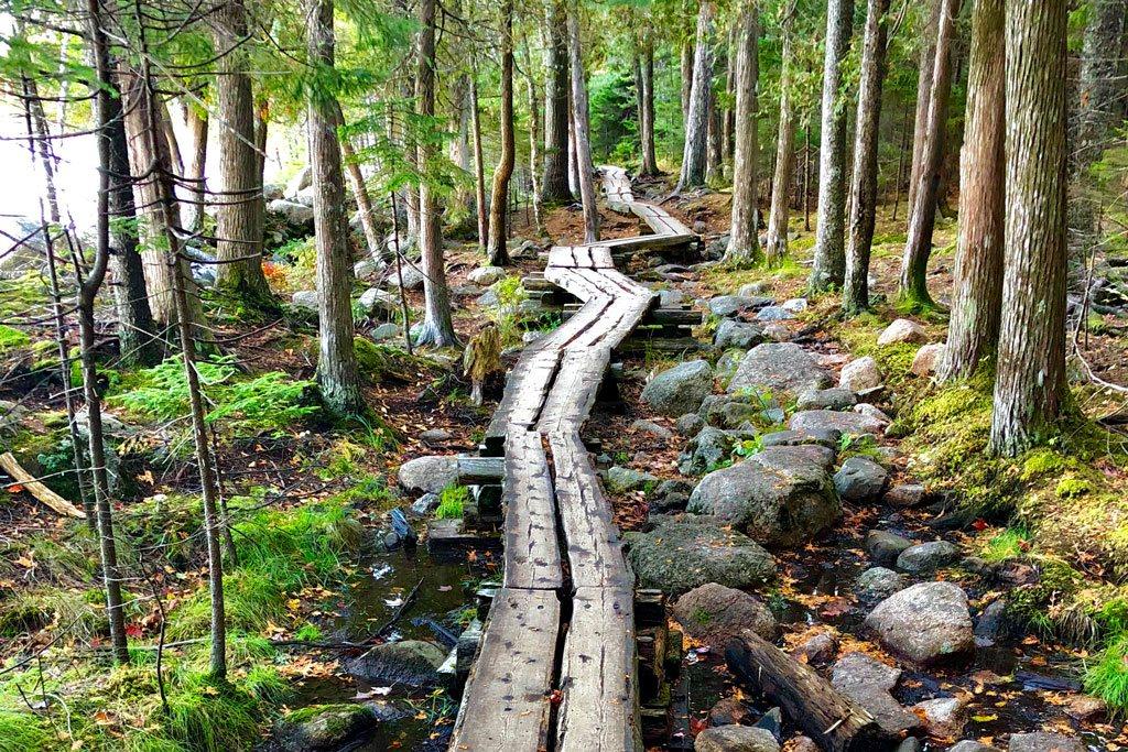
Scenery along Penobscot Mountain Trail in Acadia National Park
Hard · East Side

Penobscot Mountain Trail

Stone steps and exposed slabs above Jordan Pond.

Time3 hr
3/5 popularity
View trailhead on Google Maps ↗
Trail intel · facilities, pets & conditions
Trailhead GPSNot verified for this route; use the official NPS trail map
Route typePoint-to-point trail segment
Sun / shadeMostly open / sun-exposed
Best timeMorning
RestroomsSeasonal visitor restrooms at Jordan Pond House
ParkingJordan Pond area lots; peak congestion is midday
DogsLeashed dogs allowed, but NPS says this route is not appropriate for pets
Island ExplorerNo trail-specific stop confirmed; check the current seasonal route map
AccessibilityNo trail-specific accessible route confirmed
Nearby swimSwimming is prohibited in Jordan Pond (public water supply)
May–Jun insectsNo trail-specific black-fly note confirmed
TicksCheck yourself and clothing after the hike
Cell serviceNot verified for this route; download offline navigation before leaving service
WaterNo potable water on trail; carry your own
BringSturdy footwear, layers, and offline navigation
ChildrenNo fixed minimum age is published; use adult judgment for terrain and exposure
Fall colorEditorial foliage 3/5
WinterUnmaintained in winter; verify road access and carry traction
WildlifeNo trail-specific viewing note confirmed; keep a safe distance from all wildlife
Photo pointNo trail-specific photo point confirmed
Trail historyNo verified history line is included for this route
Plan BEmery Path
After-hike foodJordan Pond House
View trailhead on Google Maps ↗Winter guide ↗
Scenery along Acadia Mountain Loop in Acadia National Park
Hard · Quiet Side

Acadia Mountain Loop

A steep western classic with Somes Sound views.

Time2–3 hr
4/5 popularity
View trailhead on Google Maps ↗
Trail intel · facilities, pets & conditions
Trailhead GPSNot verified for this route; use the official NPS trail map
Route typeLoop
Sun / shadeMostly open / sun-exposed
Best timeMorning
RestroomsNo trail-specific facility confirmed; check the current NPS map
ParkingNo trail-specific parking note confirmed; check current NPS access guidance
DogsLeashed dogs allowed, but NPS says this route is not appropriate for pets
Island ExplorerNo trail-specific stop confirmed; check the current seasonal route map
AccessibilityNo trail-specific accessible route confirmed
Nearby swimEcho Lake Beach is nearby
May–Jun insectsNo trail-specific black-fly note confirmed
TicksCheck yourself and clothing after the hike
Cell serviceNot verified for this route; download offline navigation before leaving service
WaterNo potable water on trail; carry your own
BringSturdy footwear, layers, and offline navigation
ChildrenNo fixed minimum age is published; use adult judgment for terrain and exposure
Fall colorEditorial foliage 3/5
WinterUnmaintained in winter; verify road access and carry traction
WildlifeNo trail-specific viewing note confirmed; keep a safe distance from all wildlife
Photo pointNo trail-specific photo point confirmed
Trail historyNo verified history line is included for this route
Plan BPerpendicular Trail
After-hike foodNo specific nearby stop confirmed
View trailhead on Google Maps ↗Winter guide ↗
Scenery along Beech Mountain Loop in Acadia National Park
Moderate · Quiet Side

Beech Mountain Loop

Short summit hike to a historic fire tower.

Good with kids
Time1–1.5 hr
4/5 popularity
View trailhead on Google Maps ↗
Trail intel · facilities, pets & conditions
Trailhead GPSNot verified for this route; use the official NPS trail map
Route typeLoop
Sun / shadeMostly open / sun-exposed
Best timeMorning or late afternoon
RestroomsNo trail-specific facility confirmed; check the current NPS map
ParkingNo trail-specific parking note confirmed; check current NPS access guidance
DogsAllowed on a leash no longer than 6 ft; verify current restrictions
Island ExplorerNo trail-specific stop confirmed; check the current seasonal route map
AccessibilityNo trail-specific accessible route confirmed
Nearby swimEcho Lake Beach is nearby
May–Jun insectsNo trail-specific black-fly note confirmed
TicksCheck yourself and clothing after the hike
Cell serviceNot verified for this route; download offline navigation before leaving service
WaterNo potable water on trail; carry your own
BringWater, weather layer, and secure footwear
ChildrenCurated family pick; match distance and terrain to the youngest hiker
Fall colorEditorial foliage 3/5
WinterUnmaintained in winter; verify road access and carry traction
WildlifeNo trail-specific viewing note confirmed; keep a safe distance from all wildlife
Photo pointNo trail-specific photo point confirmed
Trail historyNo verified history line is included for this route
Plan BFlying Mountain Loop
After-hike foodNo specific nearby stop confirmed
View trailhead on Google Maps ↗Winter guide ↗
Scenery along Beech Cliff Ladder Trail in Acadia National Park
Hard · Quiet Side

Beech Cliff Ladder Trail

Ladders rise above Echo Lake to open ledges.

Time2 hr
3/5 popularity
View trailhead on Google Maps ↗
Trail intel · facilities, pets & conditions
Trailhead GPSNot verified for this route; use the official NPS trail map
Route typePoint-to-point trail segment
Sun / shadeMixed shade and open terrain
Best timeDry daylight hours
RestroomsNo trail-specific facility confirmed; check the current NPS map
ParkingNo trail-specific parking note confirmed; check current NPS access guidance
DogsNot permitted on this ladder / iron-rung route
Island ExplorerNo trail-specific stop confirmed; check the current seasonal route map
AccessibilityNo trail-specific accessible route confirmed
Nearby swimEcho Lake Beach is nearby
May–Jun insectsNo trail-specific black-fly note confirmed
TicksCheck yourself and clothing after the hike
Cell serviceNot verified for this route; download offline navigation before leaving service
WaterNo potable water on trail; carry your own
BringGrippy footwear; dry conditions; secure loose gear
ChildrenNo fixed minimum age is published; use adult judgment for terrain and exposure
Fall colorEditorial foliage 4/5
WinterNot a routine winter recommendation; ice makes ironwork and steep rock hazardous
WildlifeNo trail-specific viewing note confirmed; keep a safe distance from all wildlife
Photo pointNo trail-specific photo point confirmed
Trail historyNo verified history line is included for this route
Plan BBernard Mountain Loop
After-hike foodNo specific nearby stop confirmed
View trailhead on Google Maps ↗Winter guide ↗
Scenery along Flying Mountain Loop in Acadia National Park
Moderate · Quiet Side

Flying Mountain Loop

A small summit, big Somes Sound view, and Valley Cove.

Distance1.5 miElevation gain321 ftTime1–1.5 hr
3/5 popularity
View trailhead on Google Maps ↗
Trail intel · facilities, pets & conditions
Trailhead GPSNot verified for this route; use the official NPS trail map
Route typeLoop
Sun / shadeMostly open / sun-exposed
Best timeMorning
RestroomsNo trail-specific facility confirmed; check the current NPS map
ParkingNo trail-specific parking note confirmed; check current NPS access guidance
DogsLeashed dogs allowed, but NPS says this route is not appropriate for pets
Island ExplorerNo trail-specific stop confirmed; check the current seasonal route map
AccessibilityNo trail-specific accessible route confirmed
Nearby swimEcho Lake Beach is nearby
May–Jun insectsNo trail-specific black-fly note confirmed
TicksCheck yourself and clothing after the hike
Cell serviceNot verified for this route; download offline navigation before leaving service
WaterNo potable water on trail; carry your own
BringWind/rain layer and shoes with wet-rock grip
ChildrenNo fixed minimum age is published; use adult judgment for terrain and exposure
Fall colorEditorial foliage 2/5
WinterUnmaintained in winter; verify road access and carry traction
WildlifeNo trail-specific viewing note confirmed; keep a safe distance from all wildlife
Photo pointNo trail-specific photo point confirmed
Trail historyNo verified history line is included for this route
Plan BGreat Notch Trail
After-hike foodNo specific nearby stop confirmed
View trailhead on Google Maps ↗Winter guide ↗
Scenery along St. Sauveur Mountain in Acadia National Park
Moderate · Quiet Side

St. Sauveur Mountain

Wooded slopes lead to overlooks above Somes Sound.

Time2–3 hr
3/5 popularity
View trailhead on Google Maps ↗
Trail intel · facilities, pets & conditions
Trailhead GPSNot verified for this route; use the official NPS trail map
Route typePoint-to-point trail segment
Sun / shadeMostly wooded / shaded
Best timeDaylight; before 8am or after 5pm reduces peak congestion
RestroomsNo trail-specific facility confirmed; check the current NPS map
ParkingNo trail-specific parking note confirmed; check current NPS access guidance
DogsAllowed on a leash no longer than 6 ft; verify current restrictions
Island ExplorerNo trail-specific stop confirmed; check the current seasonal route map
AccessibilityNo trail-specific accessible route confirmed
Nearby swimNo designated swimming access confirmed for this route
May–Jun insectsBlack flies / mosquitoes can be active
TicksCheck yourself and clothing after the hike
Cell serviceNot verified for this route; download offline navigation before leaving service
WaterNo potable water on trail; carry your own
BringWater, weather layer, and secure footwear
ChildrenNo fixed minimum age is published; use adult judgment for terrain and exposure
Fall colorEditorial foliage 5/5
WinterUnmaintained in winter; verify road access and carry traction
WildlifeNo trail-specific viewing note confirmed; keep a safe distance from all wildlife
Photo pointNo trail-specific photo point confirmed
Trail historyNo verified history line is included for this route
Plan BGreat Notch Trail
After-hike foodNo specific nearby stop confirmed
View trailhead on Google Maps ↗Winter guide ↗
Scenery along Valley Peak Trail in Acadia National Park
Hard · Quiet Side

Valley Peak Trail

A rugged ridge over Somes Sound and Valley Cove.

Distance3.2 miElevation gain1,213 ftTime2–2.5 hr
1/5 popularity
View trailhead on Google Maps ↗
Trail intel · facilities, pets & conditions
Trailhead GPSNot verified for this route; use the official NPS trail map
Route typePoint-to-point trail segment
Sun / shadeMostly open / sun-exposed
Best timeDaylight; before 8am or after 5pm reduces peak congestion
RestroomsNo trail-specific facility confirmed; check the current NPS map
ParkingNo trail-specific parking note confirmed; check current NPS access guidance
DogsAllowed on a leash no longer than 6 ft; verify current restrictions
Island ExplorerNo trail-specific stop confirmed; check the current seasonal route map
AccessibilityNo trail-specific accessible route confirmed
Nearby swimNo designated swimming access confirmed for this route
May–Jun insectsNo trail-specific black-fly note confirmed
TicksCheck yourself and clothing after the hike
Cell serviceNot verified for this route; download offline navigation before leaving service
WaterNo potable water on trail; carry your own
BringSturdy footwear, layers, and offline navigation
ChildrenNo fixed minimum age is published; use adult judgment for terrain and exposure
Fall colorEditorial foliage 3/5
WinterUnmaintained in winter; verify road access and carry traction
WildlifeNo trail-specific viewing note confirmed; keep a safe distance from all wildlife
Photo pointNo trail-specific photo point confirmed
Trail historyNo verified history line is included for this route
Plan BAcadia Mountain Loop
After-hike foodNo specific nearby stop confirmed
View trailhead on Google Maps ↗Winter guide ↗
Scenery along Perpendicular Trail in Acadia National Park
Hard · Quiet Side

Perpendicular Trail

Hundreds of stone steps climb Mansell Mountain.

Time2–3 hr
3/5 popularity
View trailhead on Google Maps ↗
Trail intel · facilities, pets & conditions
Trailhead GPSNot verified for this route; use the official NPS trail map
Route typePoint-to-point trail segment
Sun / shadeMostly open / sun-exposed
Best timeDaylight; before 8am or after 5pm reduces peak congestion
RestroomsNo trail-specific facility confirmed; check the current NPS map
ParkingNo trail-specific parking note confirmed; check current NPS access guidance
DogsNot permitted on this ladder / iron-rung route
Island ExplorerNo trail-specific stop confirmed; check the current seasonal route map
AccessibilityNo trail-specific accessible route confirmed
Nearby swimNo designated swimming access confirmed for this route
May–Jun insectsNo trail-specific black-fly note confirmed
TicksCheck yourself and clothing after the hike
Cell serviceNot verified for this route; download offline navigation before leaving service
WaterNo potable water on trail; carry your own
BringGrippy footwear; dry conditions; secure loose gear
ChildrenNo fixed minimum age is published; use adult judgment for terrain and exposure
Fall colorEditorial foliage 3/5
WinterNot a routine winter recommendation; ice makes ironwork and steep rock hazardous
WildlifeNo trail-specific viewing note confirmed; keep a safe distance from all wildlife
Photo pointNo trail-specific photo point confirmed
Trail historyNo verified history line is included for this route
Plan BBernard Mountain Loop
After-hike foodNo specific nearby stop confirmed
View trailhead on Google Maps ↗Winter guide ↗
Scenery along Mansell Mountain Loop in Acadia National Park
Hard · Quiet Side

Mansell Mountain Loop

A demanding western mountain circuit above Long Pond.

Distance2.3 miElevation gain885 ftTime1.5–2 hr
3/5 popularity
View trailhead on Google Maps ↗
Trail intel · facilities, pets & conditions
Trailhead GPSNot verified for this route; use the official NPS trail map
Route typeLoop
Sun / shadeMostly open / sun-exposed
Best timeDaylight; before 8am or after 5pm reduces peak congestion
RestroomsNo trail-specific facility confirmed; check the current NPS map
ParkingNo trail-specific parking note confirmed; check current NPS access guidance
DogsAllowed on a leash no longer than 6 ft; verify current restrictions
Island ExplorerNo trail-specific stop confirmed; check the current seasonal route map
AccessibilityNo trail-specific accessible route confirmed
Nearby swimNo designated swimming access confirmed for this route
May–Jun insectsNo trail-specific black-fly note confirmed
TicksCheck yourself and clothing after the hike
Cell serviceNot verified for this route; download offline navigation before leaving service
WaterNo potable water on trail; carry your own
BringSturdy footwear, layers, and offline navigation
ChildrenNo fixed minimum age is published; use adult judgment for terrain and exposure
Fall colorEditorial foliage 3/5
WinterUnmaintained in winter; verify road access and carry traction
WildlifeNo trail-specific viewing note confirmed; keep a safe distance from all wildlife
Photo pointNo trail-specific photo point confirmed
Trail historyNo verified history line is included for this route
Plan BBernard Mountain Loop
After-hike foodNo specific nearby stop confirmed
View trailhead on Google Maps ↗Winter guide ↗
Scenery along Bernard Mountain Loop in Acadia National Park
Hard · Quiet Side

Bernard Mountain Loop

Forested western summits and historic stonework.

Distance4.3 miElevation gain1,663 ftTime3–3.5 hr
2/5 popularity
View trailhead on Google Maps ↗
Trail intel · facilities, pets & conditions
Trailhead GPSNot verified for this route; use the official NPS trail map
Route typeLoop
Sun / shadeMostly wooded / shaded
Best timeDaylight; before 8am or after 5pm reduces peak congestion
RestroomsNo trail-specific facility confirmed; check the current NPS map
ParkingNo trail-specific parking note confirmed; check current NPS access guidance
DogsAllowed on a leash no longer than 6 ft; verify current restrictions
Island ExplorerNo trail-specific stop confirmed; check the current seasonal route map
AccessibilityNo trail-specific accessible route confirmed
Nearby swimNo designated swimming access confirmed for this route
May–Jun insectsBlack flies / mosquitoes can be active
TicksCheck yourself and clothing after the hike
Cell serviceNot verified for this route; download offline navigation before leaving service
WaterNo potable water on trail; carry your own
BringSturdy footwear, layers, and offline navigation
ChildrenNo fixed minimum age is published; use adult judgment for terrain and exposure
Fall colorEditorial foliage 5/5
WinterUnmaintained in winter; verify road access and carry traction
WildlifeNo trail-specific viewing note confirmed; keep a safe distance from all wildlife
Photo pointNo trail-specific photo point confirmed
Trail historyNo verified history line is included for this route
Plan BValley Peak Trail
After-hike foodNo specific nearby stop confirmed
View trailhead on Google Maps ↗Winter guide ↗
Scenery along Great Notch Trail in Acadia National Park
Moderate · Quiet Side

Great Notch Trail

A wooded pass through the western mountains.

Time1.5–2 hr
1/5 popularity
View trailhead on Google Maps ↗
Trail intel · facilities, pets & conditions
Trailhead GPSNot verified for this route; use the official NPS trail map
Route typePoint-to-point trail segment
Sun / shadeMostly wooded / shaded
Best timeDaylight; before 8am or after 5pm reduces peak congestion
RestroomsNo trail-specific facility confirmed; check the current NPS map
ParkingNo trail-specific parking note confirmed; check current NPS access guidance
DogsAllowed on a leash no longer than 6 ft; verify current restrictions
Island ExplorerNo trail-specific stop confirmed; check the current seasonal route map
AccessibilityNo trail-specific accessible route confirmed
Nearby swimNo designated swimming access confirmed for this route
May–Jun insectsBlack flies / mosquitoes can be active
TicksCheck yourself and clothing after the hike
Cell serviceNot verified for this route; download offline navigation before leaving service
WaterNo potable water on trail; carry your own
BringWater, weather layer, and secure footwear
ChildrenNo fixed minimum age is published; use adult judgment for terrain and exposure
Fall colorEditorial foliage 5/5
WinterUnmaintained in winter; verify road access and carry traction
WildlifeNo trail-specific viewing note confirmed; keep a safe distance from all wildlife
Photo pointNo trail-specific photo point confirmed
Trail historyNo verified history line is included for this route
Plan BGilley Trail
After-hike foodNo specific nearby stop confirmed
View trailhead on Google Maps ↗Winter guide ↗
Scenery along Gilley Trail in Acadia National Park
Moderate · Quiet Side

Gilley Trail

A quiet connector on Bernard’s forested flank.

Time1.5 hr
0/5 popularity
View trailhead on Google Maps ↗
Trail intel · facilities, pets & conditions
Trailhead GPSNot verified for this route; use the official NPS trail map
Route typePoint-to-point trail segment
Sun / shadeMostly wooded / shaded
Best timeDaylight; before 8am or after 5pm reduces peak congestion
RestroomsNo trail-specific facility confirmed; check the current NPS map
ParkingNo trail-specific parking note confirmed; check current NPS access guidance
DogsAllowed on a leash no longer than 6 ft; verify current restrictions
Island ExplorerNo trail-specific stop confirmed; check the current seasonal route map
AccessibilityNo trail-specific accessible route confirmed
Nearby swimNo designated swimming access confirmed for this route
May–Jun insectsBlack flies / mosquitoes can be active
TicksCheck yourself and clothing after the hike
Cell serviceNot verified for this route; download offline navigation before leaving service
WaterNo potable water on trail; carry your own
BringWater, weather layer, and secure footwear
ChildrenNo fixed minimum age is published; use adult judgment for terrain and exposure
Fall colorEditorial foliage 5/5
WinterUnmaintained in winter; verify road access and carry traction
WildlifeNo trail-specific viewing note confirmed; keep a safe distance from all wildlife
Photo pointNo trail-specific photo point confirmed
Trail historyNo verified history line is included for this route
Plan BGreat Notch Trail
After-hike foodNo specific nearby stop confirmed
View trailhead on Google Maps ↗Winter guide ↗
Scenery along Cold Brook Trail in Acadia National Park
Moderate · Quiet Side

Cold Brook Trail

A shaded western route with stream crossings.

Time2 hr
0/5 popularity
View trailhead on Google Maps ↗
Trail intel · facilities, pets & conditions
Trailhead GPSNot verified for this route; use the official NPS trail map
Route typePoint-to-point trail segment
Sun / shadeMostly wooded / shaded
Best timeDaylight; before 8am or after 5pm reduces peak congestion
RestroomsNo trail-specific facility confirmed; check the current NPS map
ParkingNo trail-specific parking note confirmed; check current NPS access guidance
DogsAllowed on a leash no longer than 6 ft; verify current restrictions
Island ExplorerNo trail-specific stop confirmed; check the current seasonal route map
AccessibilityNo trail-specific accessible route confirmed
Nearby swimNo designated swimming access confirmed for this route
May–Jun insectsBlack flies / mosquitoes can be active
TicksCheck yourself and clothing after the hike
Cell serviceNot verified for this route; download offline navigation before leaving service
WaterNo potable water on trail; carry your own
BringWater, weather layer, and secure footwear
ChildrenNo fixed minimum age is published; use adult judgment for terrain and exposure
Fall colorEditorial foliage 5/5
WinterUnmaintained in winter; verify road access and carry traction
WildlifeNo trail-specific viewing note confirmed; keep a safe distance from all wildlife
Photo pointNo trail-specific photo point confirmed
Trail historyNo verified history line is included for this route
Plan BSt. Sauveur Mountain
After-hike foodNo specific nearby stop confirmed
View trailhead on Google Maps ↗Winter guide ↗
Scenery along Long Pond Trail in Acadia National Park
Easy · Quiet Side

Long Pond Trail

A shoreline walk with mountain reflections.

Leashed-dog pick
Time1.5–2 hr
2/5 popularity
View trailhead on Google Maps ↗
Trail intel · facilities, pets & conditions
Trailhead GPSNot verified for this route; use the official NPS trail map
Route typePoint-to-point trail segment
Sun / shadeMixed shade and open terrain
Best timeMorning
RestroomsNo trail-specific facility confirmed; check the current NPS map
ParkingNo trail-specific parking note confirmed; check current NPS access guidance
DogsAllowed on a leash no longer than 6 ft; verify current restrictions
Island ExplorerNo trail-specific stop confirmed; check the current seasonal route map
AccessibilityNo trail-specific accessible route confirmed
Nearby swimUse designated public access only; conditions vary
May–Jun insectsNo trail-specific black-fly note confirmed
TicksCheck yourself and clothing after the hike
Cell serviceNot verified for this route; download offline navigation before leaving service
WaterNo potable water on trail; carry your own
BringWater, weather layer, and secure footwear
ChildrenNo fixed minimum age is published; use adult judgment for terrain and exposure
Fall colorEditorial foliage 4/5
WinterUnmaintained in winter; verify road access and carry traction
WildlifeNo trail-specific viewing note confirmed; keep a safe distance from all wildlife
Photo pointNo trail-specific photo point confirmed
Trail historyNo verified history line is included for this route
Plan BWonderland Trail
After-hike foodNo specific nearby stop confirmed
View trailhead on Google Maps ↗Winter guide ↗
Scenery along Wonderland Trail in Acadia National Park
Easy · Quiet Side

Wonderland Trail

A family-friendly walk to tide pools and pink granite coast.

Good with kidsLeashed-dog pick
Distance1.4 miTime0.5–1 hr
4/5 popularity
View trailhead on Google Maps ↗
Trail intel · facilities, pets & conditions
Trailhead GPSNot verified for this route; use the official NPS trail map
Route typeOut-and-back
Sun / shadeMostly open / sun-exposed
Best timeNear low tide for tide pools
RestroomsNearest at Seawall picnic area
ParkingDedicated roadside trailhead lot
DogsAllowed on a leash no longer than 6 ft; verify current restrictions
Island ExplorerNo trail-specific stop confirmed; check the current seasonal route map
AccessibilityListed by NPS as suitable for mobility devices
Nearby swimNo designated swimming access confirmed for this route
May–Jun insectsNo trail-specific black-fly note confirmed
TicksCheck yourself and clothing after the hike
Cell serviceNot verified for this route; download offline navigation before leaving service
WaterNo potable water on trail; carry your own
BringWind/rain layer and shoes with wet-rock grip
ChildrenCurated family pick; match distance and terrain to the youngest hiker
Fall colorEditorial foliage 2/5
WinterUnmaintained in winter; verify road access and carry traction
WildlifeNo trail-specific viewing note confirmed; keep a safe distance from all wildlife
Photo pointPink-granite tide pools
Trail historyNo verified history line is included for this route
Plan BSeawall Shore Walk
After-hike foodNo specific nearby stop confirmed
View trailhead on Google Maps ↗Winter guide ↗
Scenery along Ship Harbor Trail in Acadia National Park
Easy · Quiet Side

Ship Harbor Trail

A figure-eight loop through spruce forest to a protected cove.

Good with kidsLeashed-dog pick
Distance1.3 miTime0.75–1 hr
4/5 popularity
View trailhead on Google Maps ↗
Trail intel · facilities, pets & conditions
Trailhead GPSNot verified for this route; use the official NPS trail map
Route typeLoop
Sun / shadeMostly open / sun-exposed
Best timeDaylight; check tide for shoreline exploring
RestroomsNearest at Seawall picnic area
ParkingDedicated roadside trailhead lot
DogsAllowed on a leash no longer than 6 ft; verify current restrictions
Island ExplorerNo trail-specific stop confirmed; check the current seasonal route map
AccessibilityFirst loop is listed by NPS as mobility-device suitable
Nearby swimNo designated swimming access confirmed for this route
May–Jun insectsNo trail-specific black-fly note confirmed
TicksCheck yourself and clothing after the hike
Cell serviceNot verified for this route; download offline navigation before leaving service
WaterNo potable water on trail; carry your own
BringWind/rain layer and shoes with wet-rock grip
ChildrenCurated family pick; match distance and terrain to the youngest hiker
Fall colorEditorial foliage 2/5
WinterUnmaintained in winter; verify road access and carry traction
WildlifeNo trail-specific viewing note confirmed; keep a safe distance from all wildlife
Photo pointNo trail-specific photo point confirmed
Trail historyNo verified history line is included for this route
Plan BSeawall Shore Walk
After-hike foodNo specific nearby stop confirmed
View trailhead on Google Maps ↗Winter guide ↗
Scenery along Bass Harbor Head Light Path in Acadia National Park
Easy · Quiet Side

Bass Harbor Head Light Path

A short rocky approach to the iconic lighthouse viewpoint.
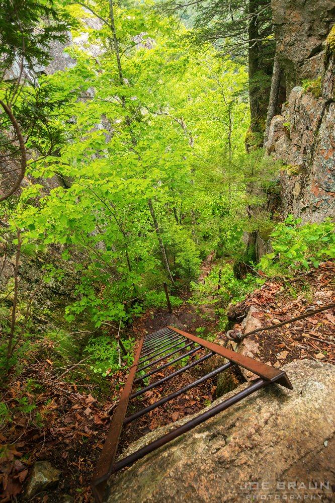
Good with kids
Time0.3–0.5 hr
4/5 popularity
View trailhead on Google Maps ↗
Trail intel · facilities, pets & conditions
Trailhead GPSBass Harbor Head Light · 44.22253, -68.33702
Route typeOut-and-back
Sun / shadeMixed shade and open terrain
Best timeSunset; arrive early
RestroomsNo trail-specific facility confirmed; check the current NPS map
ParkingSmall on-site lighthouse lot
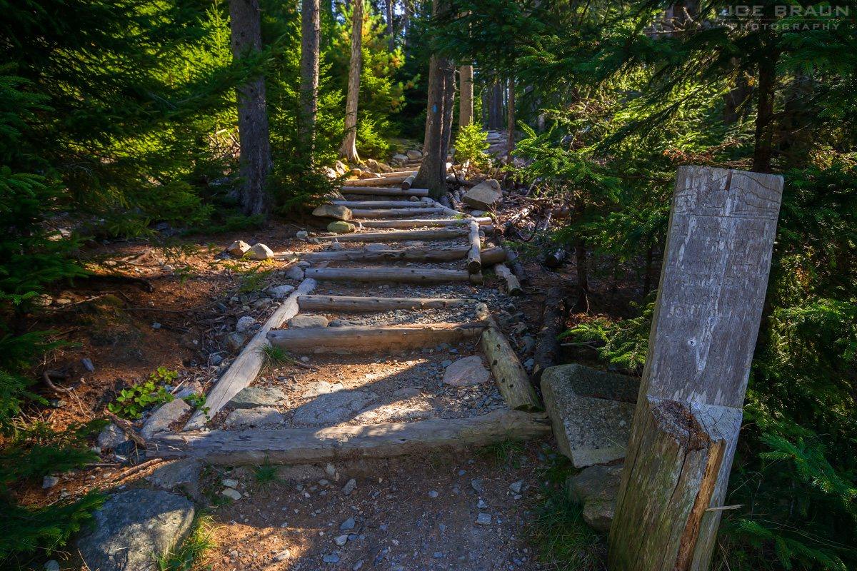
DogsAllowed on a leash no longer than 6 ft; verify current restrictions
Island ExplorerNo trail-specific stop confirmed; check the current seasonal route map
AccessibilityNo trail-specific accessible route confirmed
Nearby swimNo designated swimming access confirmed for this route
May–Jun insectsNo trail-specific black-fly note confirmed
TicksCheck yourself and clothing after the hike
Cell serviceNot verified for this route; download offline navigation before leaving service
WaterNo potable water on trail; carry your own
BringWater, weather layer, and secure footwear
ChildrenCurated family pick; match distance and terrain to the youngest hiker
Fall colorEditorial foliage 3/5
WinterUnmaintained in winter; verify road access and carry traction
WildlifeSeabirds may be visible offshore
Photo pointRocky lighthouse overlook
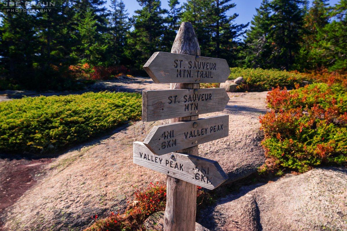
Trail historyNo verified history line is included for this route
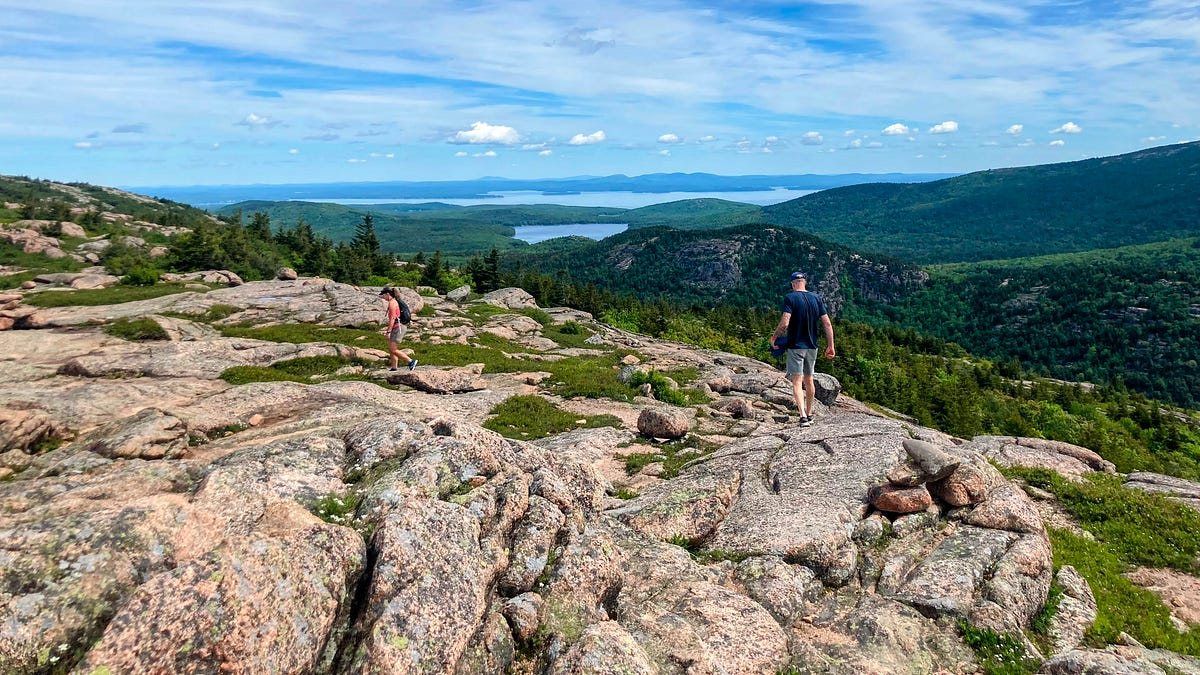
Plan BSeawall Shore Walk
After-hike foodThurston's Lobster Pound
View trailhead on Google Maps ↗Winter guide ↗
Scenery along Seawall Shore Walk in Acadia National Park
Easy · Quiet Side

Seawall Shore Walk

Low-key coastal wandering beside the natural seawall.

Leashed-dog pick
Time0.5–0.75 hr
2/5 popularity
View trailhead on Google Maps ↗
Trail intel · facilities, pets & conditions
Trailhead GPSNot verified for this route; use the official NPS trail map
Route typeOut-and-back
Sun / shadeMostly open / sun-exposed
Best timeDaylight
RestroomsSeawall picnic area
ParkingSeawall picnic-area parking
DogsAllowed on a leash no longer than 6 ft; verify current restrictions
Island ExplorerNo trail-specific stop confirmed; check the current seasonal route map
AccessibilityNo trail-specific accessible route confirmed
Nearby swimNo designated swimming access confirmed for this route
May–Jun insectsNo trail-specific black-fly note confirmed
TicksCheck yourself and clothing after the hike
Cell serviceNot verified for this route; download offline navigation before leaving service
WaterNo potable water on trail; carry your own
BringWind/rain layer and shoes with wet-rock grip
ChildrenNo fixed minimum age is published; use adult judgment for terrain and exposure
Fall colorEditorial foliage 2/5
WinterUnmaintained in winter; verify road access and carry traction
WildlifeNo trail-specific viewing note confirmed; keep a safe distance from all wildlife
Photo pointNo trail-specific photo point confirmed
Trail historyNo verified history line is included for this route
Plan BShip Harbor Trail
After-hike foodNo specific nearby stop confirmed
View trailhead on Google Maps ↗Winter guide ↗
Scenery along Schoodic Head Trail in Acadia National Park
Moderate · Schoodic

Schoodic Head Trail

A forested climb to the peninsula’s high point.

Distance0.6 miTime2–3 hr
4/5 popularity
View trailhead on Google Maps ↗
Trail intel · facilities, pets & conditions
Trailhead GPSNot verified for this route; use the official NPS trail map
Route typePoint-to-point trail segment
Sun / shadeMostly open / sun-exposed
Best timeDaylight; before 8am or after 5pm reduces peak congestion
RestroomsNo trail-specific facility confirmed; check the current NPS map
ParkingNo trail-specific parking note confirmed; check current NPS access guidance
DogsAllowed on a leash no longer than 6 ft; verify current restrictions
Island ExplorerNo trail-specific stop confirmed; check the current seasonal route map
AccessibilityNo trail-specific accessible route confirmed
Nearby swimNo designated swimming access confirmed for this route
May–Jun insectsNo trail-specific black-fly note confirmed
TicksCheck yourself and clothing after the hike
Cell serviceNot verified for this route; download offline navigation before leaving service
WaterNo potable water on trail; carry your own
BringWind/rain layer and shoes with wet-rock grip
ChildrenNo fixed minimum age is published; use adult judgment for terrain and exposure
Fall colorEditorial foliage 2/5
WinterUnmaintained in winter; verify road access and carry traction
WildlifeNo trail-specific viewing note confirmed; keep a safe distance from all wildlife
Photo pointSchoodic peninsula overlooks
Trail historyNo verified history line is included for this route
Plan BAnvil Trail
After-hike foodNo specific nearby stop confirmed
View trailhead on Google Maps ↗Winter guide ↗
Scenery along Anvil Trail in Acadia National Park
Moderate · Schoodic

Anvil Trail

Rocky ledges and spruce forest above the Schoodic coast.

Distance1.1 miTime1.5–2 hr
3/5 popularity
View trailhead on Google Maps ↗
Trail intel · facilities, pets & conditions
Trailhead GPSNot verified for this route; use the official NPS trail map
Route typePoint-to-point trail segment
Sun / shadeMostly open / sun-exposed
Best timeDaylight; before 8am or after 5pm reduces peak congestion
RestroomsNo trail-specific facility confirmed; check the current NPS map
ParkingNo trail-specific parking note confirmed; check current NPS access guidance
DogsAllowed on a leash no longer than 6 ft; verify current restrictions
Island ExplorerNo trail-specific stop confirmed; check the current seasonal route map
AccessibilityNo trail-specific accessible route confirmed
Nearby swimNo designated swimming access confirmed for this route
May–Jun insectsNo trail-specific black-fly note confirmed
TicksCheck yourself and clothing after the hike
Cell serviceNot verified for this route; download offline navigation before leaving service
WaterNo potable water on trail; carry your own
BringWind/rain layer and shoes with wet-rock grip
ChildrenNo fixed minimum age is published; use adult judgment for terrain and exposure
Fall colorEditorial foliage 2/5
WinterUnmaintained in winter; verify road access and carry traction
WildlifeNo trail-specific viewing note confirmed; keep a safe distance from all wildlife
Photo pointNo trail-specific photo point confirmed
Trail historyNo verified history line is included for this route
Plan BBuck Cove Mountain Trail
After-hike foodNo specific nearby stop confirmed
View trailhead on Google Maps ↗Winter guide ↗
Scenery along Schoodic East Trail in Acadia National Park
Hard · Schoodic

Schoodic East Trail

A short, steep scramble to Schoodic Head.

Distance0.5 miTime1 hr
3/5 popularity
View trailhead on Google Maps ↗
Trail intel · facilities, pets & conditions
Trailhead GPSNot verified for this route; use the official NPS trail map
Route typePoint-to-point trail segment
Sun / shadeMixed shade and open terrain
Best timeDaylight; before 8am or after 5pm reduces peak congestion
RestroomsNo trail-specific facility confirmed; check the current NPS map
ParkingNo trail-specific parking note confirmed; check current NPS access guidance
DogsAllowed on a leash no longer than 6 ft; verify current restrictions
Island ExplorerNo trail-specific stop confirmed; check the current seasonal route map
AccessibilityNo trail-specific accessible route confirmed
Nearby swimNo designated swimming access confirmed for this route
May–Jun insectsNo trail-specific black-fly note confirmed
TicksCheck yourself and clothing after the hike
Cell serviceNot verified for this route; download offline navigation before leaving service
WaterNo potable water on trail; carry your own
BringSturdy footwear, layers, and offline navigation
ChildrenNo fixed minimum age is published; use adult judgment for terrain and exposure
Fall colorEditorial foliage 3/5
WinterUnmaintained in winter; verify road access and carry traction
WildlifeNo trail-specific viewing note confirmed; keep a safe distance from all wildlife
Photo pointNo trail-specific photo point confirmed
Trail historyNo verified history line is included for this route
Plan BNo nearby alternate is assigned
After-hike foodNo specific nearby stop confirmed
Scenery along Buck Cove Mountain Trail in Acadia National Park
Moderate · Schoodic

Buck Cove Mountain Trail

A quiet interior path through spruce and granite.

Distance3.2 miTime2 hr
1/5 popularity
View trailhead on Google Maps ↗
Trail intel · facilities, pets & conditions
Trailhead GPSNot verified for this route; use the official NPS trail map
Route typePoint-to-point trail segment
Sun / shadeMostly wooded / shaded
Best timeDaylight; before 8am or after 5pm reduces peak congestion
RestroomsNo trail-specific facility confirmed; check the current NPS map
ParkingNo trail-specific parking note confirmed; check current NPS access guidance
DogsAllowed on a leash no longer than 6 ft; verify current restrictions
Island ExplorerNo trail-specific stop confirmed; check the current seasonal route map
AccessibilityNo trail-specific accessible route confirmed
Nearby swimNo designated swimming access confirmed for this route
May–Jun insectsBlack flies / mosquitoes can be active
TicksCheck yourself and clothing after the hike
Cell serviceNot verified for this route; download offline navigation before leaving service
WaterNo potable water on trail; carry your own
BringWater, weather layer, and secure footwear
ChildrenNo fixed minimum age is published; use adult judgment for terrain and exposure
Fall colorEditorial foliage 5/5
WinterUnmaintained in winter; verify road access and carry traction
WildlifeNo trail-specific viewing note confirmed; keep a safe distance from all wildlife
Photo pointNo trail-specific photo point confirmed
Trail historyNo verified history line is included for this route
Plan BSchoodic Head Trail
After-hike foodNo specific nearby stop confirmed
View trailhead on Google Maps ↗Winter guide ↗
Scenery along Bowditch Trail in Acadia National Park
Moderate · Isle au Haut

Bowditch Trail

Rough island hiking through wooded uplands.

Distance2.0 miTime1.5 hr
0/5 popularity
View trailhead on Google Maps ↗
Trail intel · facilities, pets & conditions
Trailhead GPSDuck Harbor · 44.02788, -68.64921
Route typePoint-to-point trail segment
Sun / shadeMostly wooded / shaded
Best timeDaylight; coordinate with the mail boat
RestroomsNo trail-specific facility confirmed; check the current NPS map
ParkingNo trail-specific parking note confirmed; check current NPS access guidance
DogsAllowed on a leash no longer than 6 ft; verify current restrictions
Island ExplorerNo trail-specific stop confirmed; check the current seasonal route map
AccessibilityNo trail-specific accessible route confirmed
Nearby swimNo designated swimming access confirmed for this route
May–Jun insectsBlack flies / mosquitoes can be active
TicksCheck yourself and clothing after the hike
Cell serviceNot verified for this route; download offline navigation before leaving service
WaterNo potable water on trail; carry your own
BringWater, weather layer, and secure footwear
ChildrenNo fixed minimum age is published; use adult judgment for terrain and exposure
Fall colorEditorial foliage 5/5
WinterUnmaintained in winter; verify road access and carry traction
WildlifeNo trail-specific viewing note confirmed; keep a safe distance from all wildlife
Photo pointNo trail-specific photo point confirmed
Trail historyNo verified history line is included for this route
Plan BGoat Trail
After-hike foodNo specific nearby stop confirmed
View trailhead on Google Maps ↗Winter guide ↗
Scenery along Duck Harbor Mountain in Acadia National Park
Hard · Isle au Haut

Duck Harbor Mountain

A difficult island climb above Duck Harbor.

Distance1.2 miTime1.5 hr
2/5 popularity
View trailhead on Google Maps ↗
Trail intel · facilities, pets & conditions
Trailhead GPSDuck Harbor · 44.02788, -68.64921
Route typeOut-and-back
Sun / shadeMostly open / sun-exposed
Best timeDaylight; coordinate with the mail boat
RestroomsNo trail-specific facility confirmed; check the current NPS map
ParkingNo trail-specific parking note confirmed; check current NPS access guidance
DogsAllowed on a leash no longer than 6 ft; verify current restrictions
Island ExplorerNo trail-specific stop confirmed; check the current seasonal route map
AccessibilityNo trail-specific accessible route confirmed
Nearby swimNo designated swimming access confirmed for this route
May–Jun insectsNo trail-specific black-fly note confirmed
TicksCheck yourself and clothing after the hike
Cell serviceNot verified for this route; download offline navigation before leaving service
WaterNo potable water on trail; carry your own
BringSturdy footwear, layers, and offline navigation
ChildrenNo fixed minimum age is published; use adult judgment for terrain and exposure
Fall colorEditorial foliage 3/5
WinterUnmaintained in winter; verify road access and carry traction
WildlifeNo trail-specific viewing note confirmed; keep a safe distance from all wildlife
Photo pointNo trail-specific photo point confirmed
Trail historyNo verified history line is included for this route
Plan BNo nearby alternate is assigned
After-hike foodNo specific nearby stop confirmed
Scenery along Goat Trail in Acadia National Park
Moderate · Isle au Haut

Goat Trail

Rocky shoreline and remote island character.

Distance2.1 miTime1.25 hr
1/5 popularity
View trailhead on Google Maps ↗
Trail intel · facilities, pets & conditions
Trailhead GPSDuck Harbor · 44.02788, -68.64921
Route typePoint-to-point trail segment
Sun / shadeMostly open / sun-exposed
Best timeDaylight; coordinate with the mail boat
RestroomsNo trail-specific facility confirmed; check the current NPS map
ParkingNo trail-specific parking note confirmed; check current NPS access guidance
DogsAllowed on a leash no longer than 6 ft; verify current restrictions
Island ExplorerNo trail-specific stop confirmed; check the current seasonal route map
AccessibilityNo trail-specific accessible route confirmed
Nearby swimNo designated swimming access confirmed for this route
May–Jun insectsNo trail-specific black-fly note confirmed
TicksCheck yourself and clothing after the hike
Cell serviceNot verified for this route; download offline navigation before leaving service
WaterNo potable water on trail; carry your own
BringWind/rain layer and shoes with wet-rock grip
ChildrenNo fixed minimum age is published; use adult judgment for terrain and exposure
Fall colorEditorial foliage 2/5
WinterUnmaintained in winter; verify road access and carry traction
WildlifeSeabirds and marine wildlife may be visible offshore
Photo pointNo trail-specific photo point confirmed
Trail historyNo verified history line is included for this route
Plan BBowditch Trail
After-hike foodNo specific nearby stop confirmed
View trailhead on Google Maps ↗Winter guide ↗
Scenery along Western Head Trail in Acadia National Park
Moderate · Isle au Haut

Western Head Trail

A rugged coastal loop at the island’s western edge.

Distance1.3 miTime1.25 hr
1/5 popularity
View trailhead on Google Maps ↗
Trail intel · facilities, pets & conditions
Trailhead GPSDuck Harbor · 44.02788, -68.64921
Route typePoint-to-point trail segment
Sun / shadeMostly open / sun-exposed
Best timeDaylight; coordinate with the mail boat
RestroomsNo trail-specific facility confirmed; check the current NPS map
ParkingNo trail-specific parking note confirmed; check current NPS access guidance
DogsAllowed on a leash no longer than 6 ft; verify current restrictions
Island ExplorerNo trail-specific stop confirmed; check the current seasonal route map
AccessibilityNo trail-specific accessible route confirmed
Nearby swimNo designated swimming access confirmed for this route
May–Jun insectsNo trail-specific black-fly note confirmed
TicksCheck yourself and clothing after the hike
Cell serviceNot verified for this route; download offline navigation before leaving service
WaterNo potable water on trail; carry your own
BringWind/rain layer and shoes with wet-rock grip
ChildrenNo fixed minimum age is published; use adult judgment for terrain and exposure
Fall colorEditorial foliage 2/5
WinterUnmaintained in winter; verify road access and carry traction
WildlifeSeabirds and marine wildlife may be visible offshore
Photo pointNo trail-specific photo point confirmed
Trail historyNo verified history line is included for this route
Plan BBowditch Trail
After-hike foodNo specific nearby stop confirmed
View trailhead on Google Maps ↗Winter guide ↗

Beehive Loop

Know before you go

Why it stands out

Complete practical guide

Everything confirmed for this route in one place. Hiking times use published figures where available; otherwise they are planning estimates based on distance, elevation gain, and terrain difficulty.

0 selected